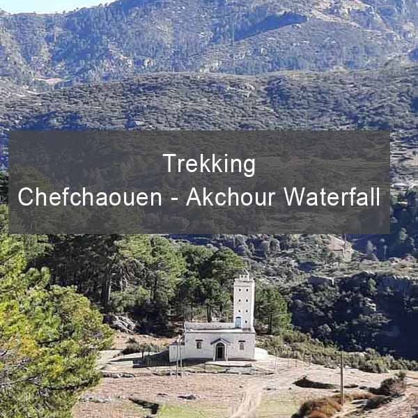
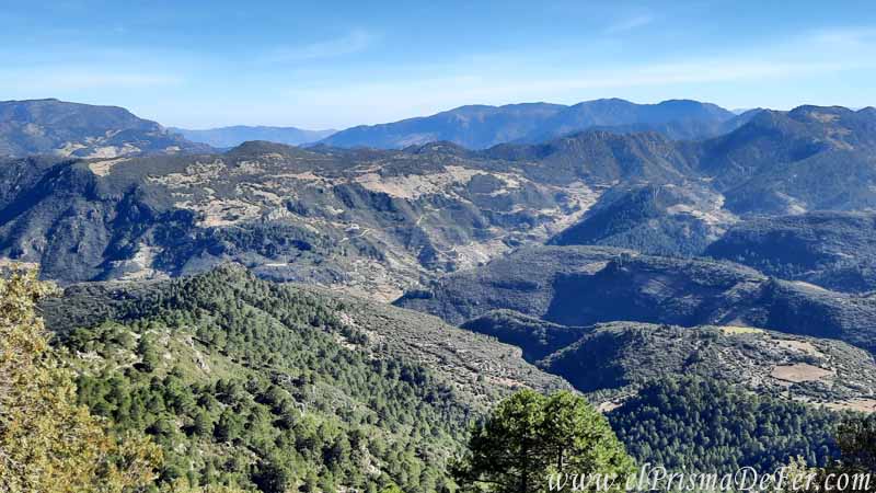
Exploring the Rif Mountains on a trek from Chefchaouen to Akchour Waterfall doesn't offer the most epic landscapes in Morocco, but it does offer a deeply authentic experience.
What truly stands out about this journey is the solitude of the road, far from mass tourism, and the direct contact with rural life.
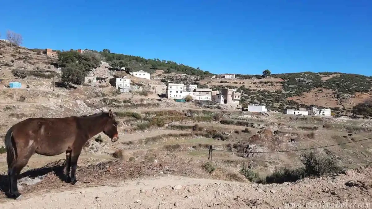
As you travel along dirt paths and green hills, you pass through small villages where life goes by at the pace of the countryside.
In many of them, hashish crops, permitted for medicinal and ancestral use, are part of the everyday landscape and reflect a little-known but very present local reality.
Despite what this context might suggest, at no point did I feel unsafe; the people were friendly, curious, and the atmosphere was very calm.
If you're looking for an authentic experience off the beaten track, the trek that connects Chefchaouen with the Akchour waterfalls is a unique journey through the heart of the Rif.
This post may contains affiliate links. If you purchase through these links, I may earn a commission at no extra cost to you. Thank you for your support!
Table of Contents
🗺️ Chefchaouen – Akchour Trekking Fact Sheet
| Start |
| Chefchaouen |
| Final |
| Akchour Waterfall (park´s entrance) |
| Duration |
| 2 days |
| Distance |
| 38 km |
| Estimated time in hours |
| 13.5 hs |
| Max. Altitude |
| 1800m |
| Difficulty |
| Moderate |
| Signaling |
| Scarce/None |
| Water/food |
| Restock in Azilane |
Do you want to follow this route precisely?
Download the KML file for the Akchour waterfall trekking and open it in apps like Maps.me or Gaia GPS to have the complete route offline. Ideal if you want to navigate the valley with confidence, even without a signal.
Download the route on Gumroad for a symbolic contribution.

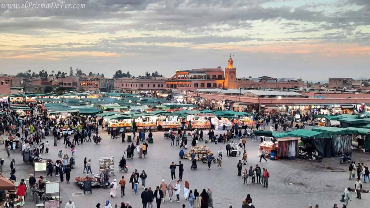
How to get to Chefchaouen
The most common and economical option to get to Chefchaouen is by bus. CTM and Supratours are the most reliable and comfortable companies for tourists to travel in Morocco.
Can I trek the Rif Mountains alone or do I need a guide?
Although this route isn't officially marked, it's perfectly possible to hike independently without a guide. However, it's important to have some prior experience in mountain hiking and navigation with offline maps or GPS, as the trail isn't well marked in some sections, making it easy to get lost.
For those who aren't entirely comfortable with that idea, there are one-day or 2-day tours that cover part of this route, including a visit to the Akchour waterfalls and other areas of the Rif, with transportation and a local guide included.
The Akchour waterfall trek is part of the 3 and 4-week Morocco travel itinerary. If you'd like to learn more, I invite you to read it.
📌 Practical tips for hiking in the Rif Mountains
Wear good shoes and enough water
Although the terrain isn't technically difficult, there are constant climbs and long stretches between villages. Furthermore, the sun can be intense even outside of summer. There aren't always homes or reliable sources of water along the way.
Essential offline map
I recommend using Maps.me with the downloaded map of the area. The app has marked trails as well as small villages like Afescar, Bunnar, Agla, and Taurart, which is very useful for stretches without signal. You can mark your route beforehand or record the track as you walk.
Sleeping in Azilane
It's a good option for splitting the trip into two days. It's a very quiet town, with some rural accommodation options or the possibility of camping if you're prepared. Arrange everything in advance if you're not bringing a tent.
A must-see place to spend the night is the Gîte Montagne Azilane, a hostel where the few travelers who take this route usually stay.
Feeding
Bring provisions. In some villages, you may find bread, cheese, or fruit, but there's no guarantee. If you're a vegetarian, it's best to be prepared.
Safety and respect
Although hashish is grown in the area, locals are used to seeing hikers and are generally friendly if treated with respect. Don't photograph fields or people without asking permission, and don't interfere with paths or awkward conversations.
Climate and season
Spring and fall are ideal. In summer, it can be very hot, and in winter, rain can make the road slippery.
You can read the complete travel guide to Morocco. There you have all the information you need to plan your trip to this fantastic country.

Guide Map for Trekking from Chefchaouen to Akchour
Day 1 of the Hiking: Chefchaouen – Azilane
| Distance |
| 13 km |
| Estimated time |
| 5 hs with 30 minutes |
| Elevation Profile |
| 1800 mts y 640 mts |
Beginning of the Hiking in the Rif Mountains
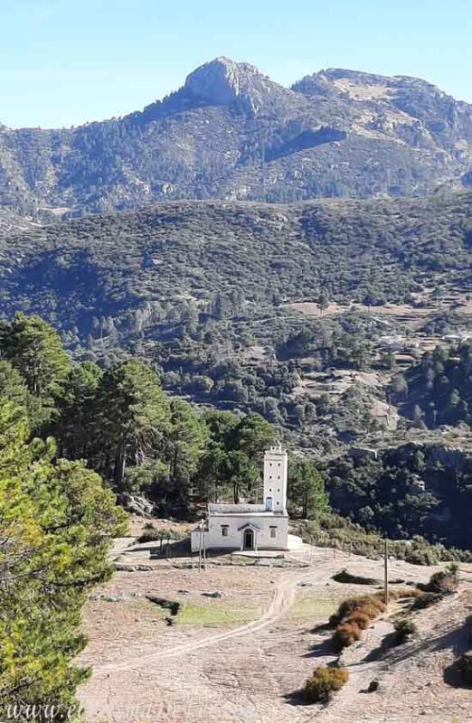
The hike begins from Chefchaouen, heading in the direction of the Spanish Mosque. Before reaching the fork that leads up to it, a trail branches off in the opposite direction, marking the beginning of the route (see Point 0 – Start on the map). The path begins with a zigzag section that quickly heads into the mountains.
During this first part, the trail sometimes gets lost among the rocks or becomes blurred, but the general orientation remains fairly clear (see map Point 1 – First Ascent). As we gain altitude, we begin to encounter what appear to be animal trails, and some scattered houses of local villagers begin to appear between the hills.
After continuing uphill for a while, we finally connect with a wider dirt road, also used by vehicles (Point 2 – Intersection with the highway). From there, the route becomes easier to follow. Just continue along the same road, which runs straight for a long stretch, until you reach a rather steep zigzag climb (Point 3 – Steep zigzag climb).
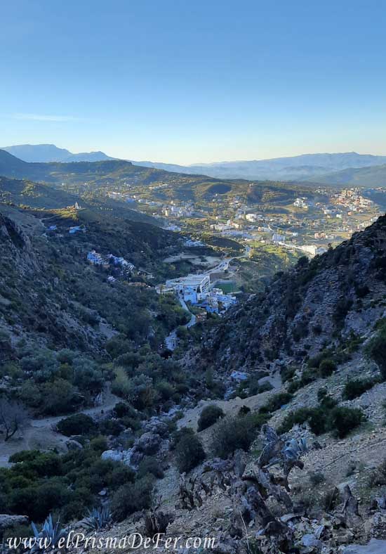
On the way to the village of Azilane
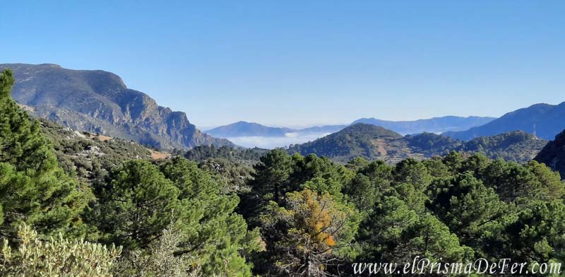
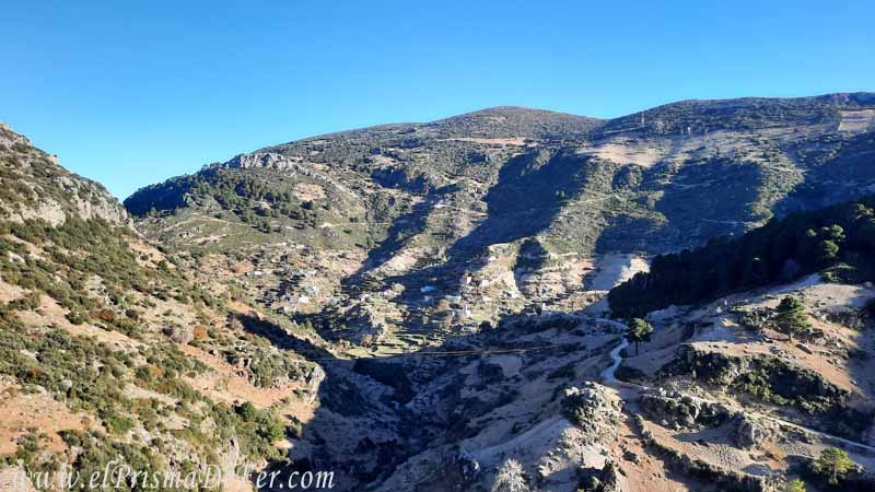
After overcoming that last steep incline, the trail becomes more gentle. Without major detours, the journey continues through gentle climbs and descents along rural roads, where greenery dominates every corner. The views of the valley begin to open up generously, both behind us and toward the mountains rising in front. Sometimes, the silence of the forest is interrupted by the cries and leaps of monkeys, who hide among the trees, making their wild presence felt.
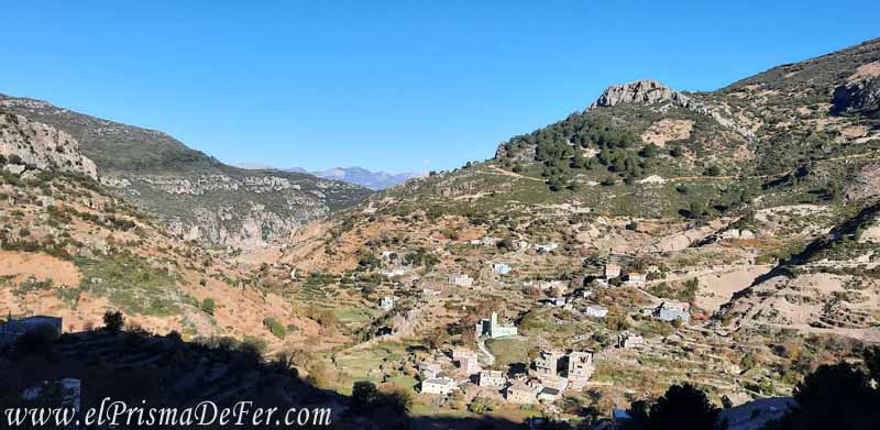
The goal of the first day is to reach Azilane, a small mountain village tucked away among hills covered in crops. There you can spend the night in simple accommodation or with family members (it's advisable to bring a coat, as it gets quite cool when the sun sets). The silence in Azilane is profound, broken only by the crowing of roosters or the dry, rhythmic sound coming from some houses, where locals are working with the harvested hashish (Point 6 – Azilane).
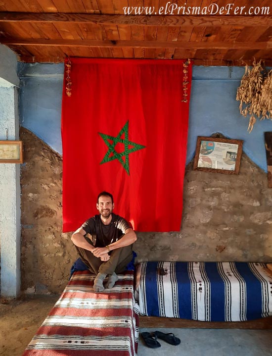
A highly recommended place to spend the night is the Gîte Montagne Azilane, a hostel that usually hosts the few travelers who make this trek. It usually includes dinner, breakfast, and a comfortable bed. The owner, in addition to speaking perfect English, gives very good directions for the next stage of the trek.
When I was there, besides me, there was only one local family who had arrived by car. They invited me to dinner in a separate room, as is customary in many traditional villages, but always with kind gestures and genuine hospitality. There's something special about the night in Azilane: the complete disconnection feels like a true retreat, surrounded by nature.
Day 2: Azilane – Akchour – Chefchaouen
| Distance |
| 25 km |
| Estimated time |
| 8 hours |
| Elevation Profile |
| 1500 mts y 370 mts |
After a hearty breakfast at the Gîte Montagne Azilane, and with clear instructions from the owner, it's ideal to start the day early to avoid being late when we reach the waterfall and return to the city.
From Azilane, we took the dirt road east, heading for the village of Afescar. From there, there's an alternative trail that goes directly to the Bridge of God and then connects with the path to the Akchour waterfall. I understand this route is a bit shorter, although it passes through fewer Rif villages. I didn't personally hike it, but you can see its route on Maps.me (Point 7 – Afescar).
Following the main route, the path continues with gentle climbs and descents, passing through small mountain villages such as Amazzar, Bunnar, Agla. Each one seems suspended in time: adobe houses, children waving with curiosity and a peace that can only be found in these remote corners of the world.
After several hours of hiking, before reaching the village of Taurat, there is a hidden detour that leads to the Akchour waterfall (Point 9 – Detour to the Waterfall). It's not easy to find, even using GPS, as there are no clearly marked trails. In my case, it was a farmer who helped me. He saw me coming and going, clearly lost, and although he didn't speak English, he understood I was looking for the waterfall. He pointed out a path with a simplicity that at that moment was golden.
From there, the trail skirts the canyon formed by the river. The vegetation becomes denser, thorny bushes appear, and the terrain becomes more rocky. I'm not sure if I followed the right path or if I accidentally strayed, but the slope became very steep and slippery. However, the sound of the waterfall and some gaps in the vegetation confirmed that I was heading in the right direction (Point 10 – Steep Descent to the Waterfall).
It was the loneliest stretch of the trail. For the first time, I truly felt the weight of being alone, with no sign, no other hikers in sight, and far from any town. If something happened to me, I wasn't sure who would know.
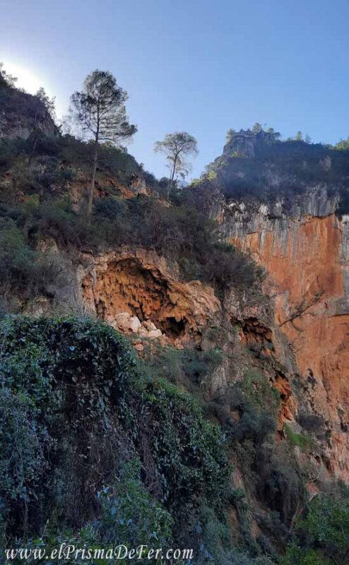
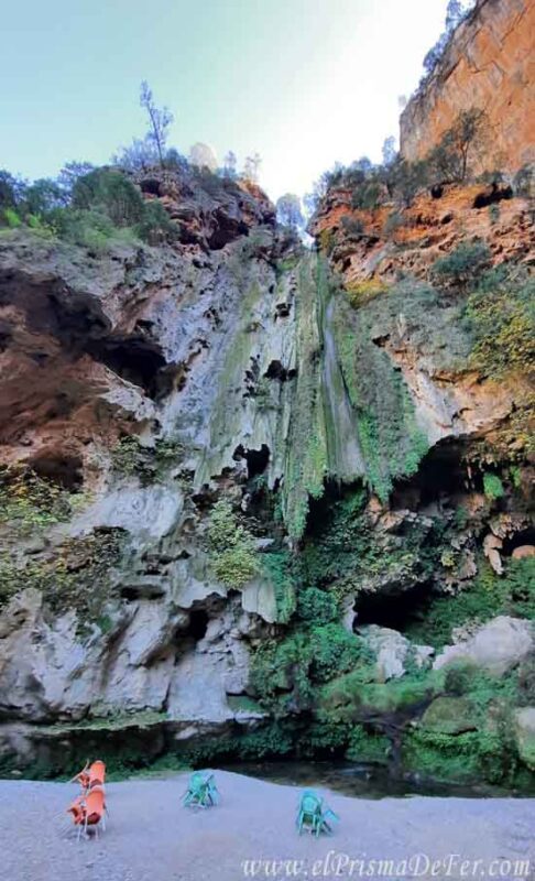
Arrival at Akchour Waterfall
The trail eventually descends steeply toward the Akchour waterfall. Relieved to finally reach a spot frequented by other people, I was met with a not entirely pleasant surprise. Where I had expected a great flow of water, with a visual and audible reward after so many hours of hiking, there was only a thin trickle cascading down the rock face. Of course, it was November, just before the winter rains, and the river was at one of its lowest points. Not even enough for a good dip.
The best part of that stop, however, was meeting a group of three Moroccans who had come from Tetouan to spend the day. One of them spoke perfect Spanish, and after a good chat over a bite to eat to recharge our batteries, we immediately connected.
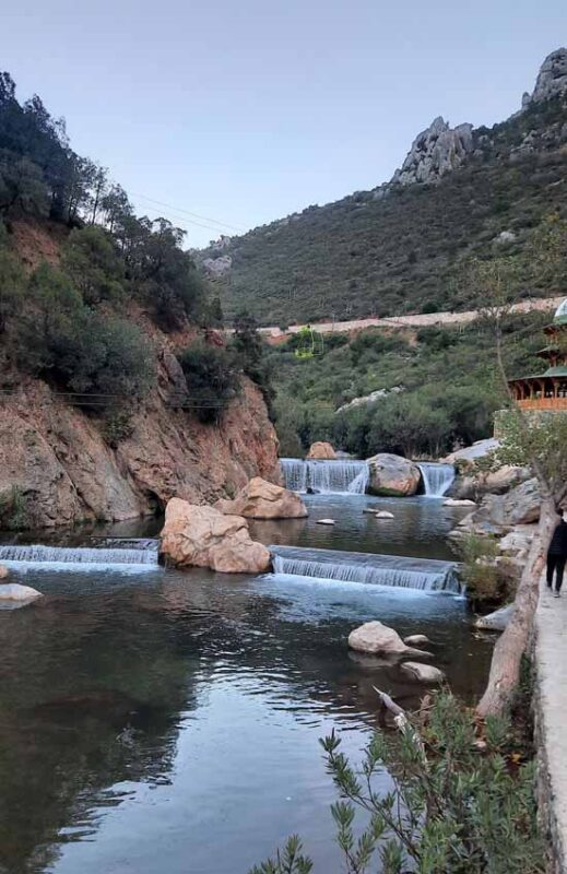
They accompanied me all the way out of the park (1.5 to 2 hours) to the entrance of the complex. It's a very popular area with locals, who often come by car to spend the day. There are restaurants, playgrounds, sports facilities, and a lively atmosphere. Being so close to large cities like Tetouan and Tangier, many choose it as a picnic or weekend getaway.
How to get back to Chefchaouen from Akchour
This final part of the Rif trek can be the most tedious, so it's best to arm yourself with patience.
Once you finish the tour and leave the park on the side of Akchour Waterfall, you have several options for returning. If you don't want to walk back to Chefchaouen (which would be quite a long journey), you can take a taxi to a city center or directly to the Blue City. You can also arrange transportation in advance to meet you at a prearranged time. Of course, these options are usually more expensive than the one I'm going to tell you about below.
There's a taxi stand from the main parking lot (on the map: Taxi Stand 1), but as you might imagine, prices are higher due to this being a tourist area. If you want to save money on the return trip, I recommend this option:
- From the parking lot, hitchhike or take a taxi to the intersection with Route N2, which passes through Tetuán and heads south. (Shared Taxi Stops 2a and 2b)
- From taxi stand 2a or 2b, there are usually cars/taxis waiting to gather people and take them all in the same direction.
- You're likely to see taxis coming from Tetouan, but heading south, not directly to Chefchaouen. In that case, they'll offer to drop you off at a gas station near the roundabout where the road forks toward the Blue City (Shared Taxi Stop 3 on the map).
- From there it's easier, because the taxi waiting at the gas station is there to take passengers to Chefchaouen.
It sounds cumbersome, and it can take some time to get back, especially because of the number of transfers involved, but it is the most economical way to get from Akchour Falls to Chefchaouen.
I was a bit lucky because the Moroccans I met at the waterfall were the ones who explained all these steps to me, and they also did me the favor of taking me to taxi stops 2a and 2b.
Save this post on Pinterest

Final thoughts on the Chefchaouen – Akchour Hiking
This trek may not offer the most epic views or picture-postcard snow-capped peaks. But what it lacks in spectacularity, it more than makes up for in authenticity. Walking alone along rural trails, passing through villages where time seems to stand still, and sharing moments with locals who live a different reality leaves a distinct impression. That feeling of being far from it all, of not seeing another traveler for hours, of hearing only your footsteps and the sounds of the countryside... is incredibly valuable.
So, if you're looking for a different experience in Morocco, beyond the classic routes, I recommend this tour. It's not just a trek: it's a small window into life in the Rif Mountains. And those are also the things you take away from your travels.
Frequently Asked Questions – 2-Day Trek from Chefchaouen to Akchour Waterfalls Crossing the Rif Mountains
What does this trek consist of?
It's a two-day trek connecting Chefchaouen with Akchour, crossing the Rif Mountains along rural trails. Unlike the typical waterfall excursion, this route ventures into more secluded areas, passing through Berber villages, cultivated fields, and mountain landscapes.
How much walking is involved and how demanding is it?
In total it's about 20 to 30 km, spread over two days. The first day is usually the longest and most demanding, with several hours of climbing, while the second tends to be easier, with sections of descent towards Akchour.
Is the path well signposted?
No, and this is one of the key points. Some sections are dirt roads, but other parts have barely visible trails. That's why it's important to have an offline GPS track or good navigation skills.
Is it advisable to do it with a guide?
It's not mandatory, but it can be helpful. A local guide not only makes navigation easier, but also provides a better understanding of life in the region.
Where do you sleep during the trek?
The most common option is to spend the night in a local home in a village in the Rif Mountains. This is an interesting part of the trip, as it allows you to spend time with local families, share home-cooked meals, and see firsthand what life is like in these mountains.
How is the food handled?
There's no tourist infrastructure like in Akchour, so it's normal to have dinner and breakfast at your accommodation and bring some snacks for the hike. If you're trekking with a guide, this is usually already arranged.
What is the best time to do it?
Spring is probably the best time, with pleasant temperatures and lush greenery. Autumn is also a good time. Summer can be quite hot, and winter rains can make the trails difficult.
Can it be done independently?
Yes, it's possible to do it on your own if you have a GPS and some mountain experience. However, it's not as "plug and play" a trek as some others, so it's best to be prepared or at least know where you're going to sleep.
How do you get back from Akchour?
Once in Akchour, you can take a shared taxi back to Chefchaouen. It's a short journey, about 30 to 45 minutes.
Video of the Chefchaouen hiking– Akchour Waterfall
Support The Prism of Fer!
Your support helps me continue creating free content on the blog. Thank you so much!