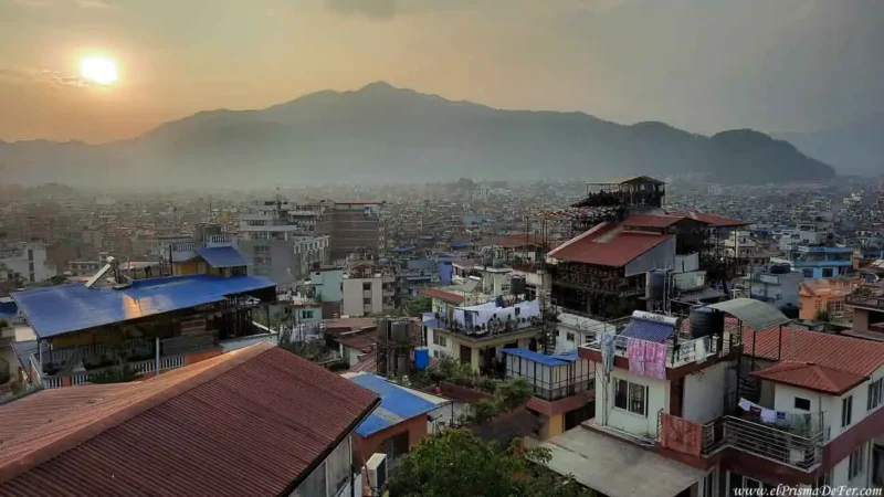
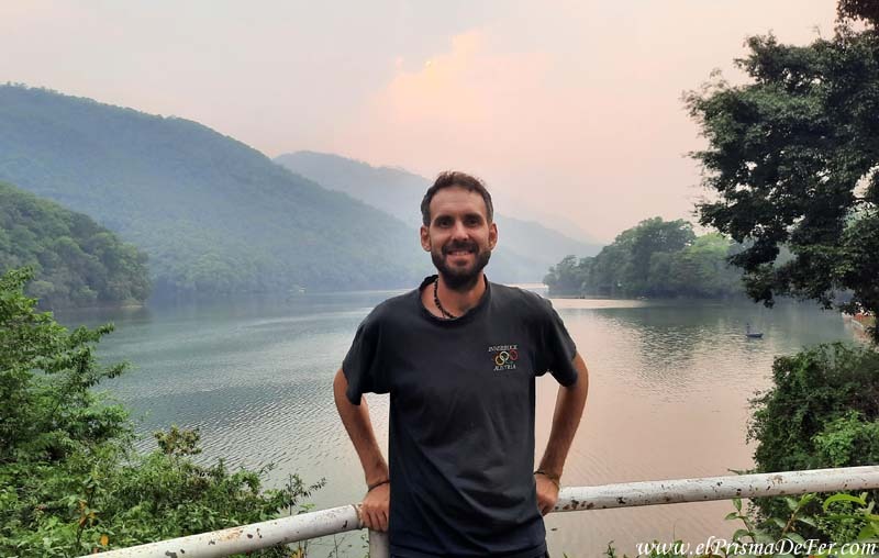
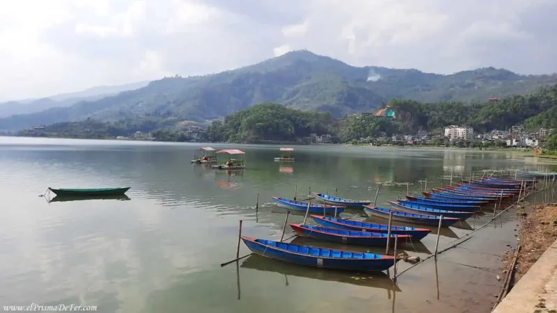
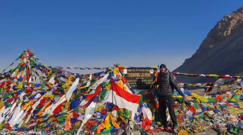
After completing the Annapurna circuit and descending to Tatopani, I decided to continue walking for a few more days to cross to the other side of the massif and reach base camp.
Combining both treks was one of the best decisions of the trip. Not only because of the landscapes, which remain spectacular, but also because of the opportunity to discover another side of this region, with new villages, much greener surroundings, and a route full of ups and downs that add a different dynamic to the hike.
In this post I'll tell you about my experience trekking to Annapurna Base Camp from Tatopani on my own: the stages I walked, the characteristics of each one, the times, and tips so you can have a clear idea of what to expect.

This post may contains affiliate links. If you purchase through these links, I may earn a commission at no extra cost to you. Thank you for your support!
Table of Contents
🗺️ Technical sheet for the trek to Annapurna Base Camp
| Start |
| Tatopani |
| Final |
| Jhinu Danda |
| Duration |
| 5 days |
| Distance |
| ~80 km |
| Accommodation |
| Teahouses |
| Max. Altitude |
| 4100 mts |
| Difficulty |
| Moderate |
| Signaling |
| Good |
| Water/food |
| In every town |
Do you want to follow this route precisely?
Download the KML/KMZ file of the trek I did to reach Annapurna Base Camp, and open it in apps like Maps.me, AllTrails, or Gaia GPS to have the complete route offline. Ideal if you want to move around the valley with confidence, even without cell service.
Download the Annapurna Base Camp trek on Gumroad for a low cost. You can also download the Annapurna Circuit trek or even take advantage of the both kit for a better price.

How to organize a trek to Annapurna Base Camp
If you're planning a trek to Annapurna Base Camp and want to delve into the more practical aspects —permits, accommodations, logistics, costs and tips for organizing it on your own— I've covered all of that in detail in another blog post.
There you will find the information you need to plan your route in advance and avoid surprises along the way.
Detailed itinerary of the trek to Annapurna Base Camp
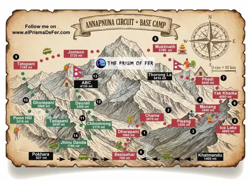
Day 1: Tatopani – ascent to Ghorepani
| Distance |
| 14 km |
| Estimated time |
| 6/7 hs |
| Elevation Profile |
| From 1200 mts to 2.900 mts |
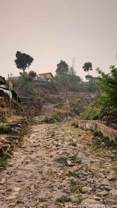
After the rest day I had at the Tatopani hot springs, where I was pampering myself after finishing the Annapurna circuit, I started the new trek with a day that ended up being, probably, the most demanding stage of all my days walking in the region, physically speaking.
I went from sleeping at about 1100 meters to ending the day at nearly 2800 meters, with 1700 meters of positive elevation gain in a single day…very tough.
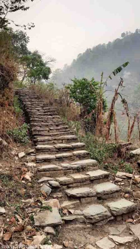
It was a 6-hour climb, almost constant, between endless stone stairs and dirt paths, without much rest.
By the end of the day, the change was noticeable. I left behind the warm climate of Tatopani and was suddenly thrust back into the cold of the mountains. During the last few hours, I moved at a much slower pace, conserving my energy.
Despite the effort, I enjoyed the day. There's so much greenery, and the path passes through several small villages with rice terraces and people working in the fields, something I hadn't seen much of on the other side of the mountain range.
I came across very few tourists, as this stretch is not very busy, so the immersion was total.
The only downside was that I saw the smoke again, hanging over the valley, just like during the first few days of the tour. It was back, covering the highest mountains and barely obscuring the nearby hills.
For a moment I doubted whether it was worth continuing to ABC, but I decided to keep going, hoping the weather would change further on. You never know in the mountains; sometimes a single rain shower is enough to clear the air and completely transform the landscape in a matter of hours.
Day 2: Ghorepani – Poon Hill – Tadapani – Chhomrong
| Distance |
| 20 km |
| Estimated time |
| 6/8 hs |
| Elevation Profile |
| From 2900 mts to 1900 mts |
Poon Hill
From Ghorepani you can access Poon Hill, one of the most famous viewpoints in the entire Annapurna region.
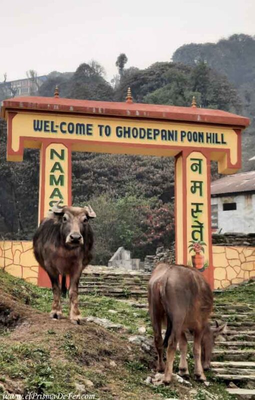
It's a short trek, very popular for the panoramic views of the massif on a clear day. From the top, you can see several of the highest peaks lined up, illuminated by the sunrise. In fact, many groups only go as far as this point and then return to Pokhara, without continuing on to base camp.
The typical plan is to leave before dawn to watch the sunrise. I went as far as the entrance to the viewpoint, where there was a small entrance fee. But seeing that the smoke was still covering the entire sky, and that I couldn't see a thing, I decided not to go up.
Tadapani
The second day also ended up being longer than expected. The usual thing is to stop in Tadapani, a small village about 7–8 km from Ghorepani, a fairly short distance, so I arrived relatively early.
With a good margin of time and energy, I decided to continue to Chhomrong, adding another 10–12 km and combining two stages into one. This transformed the day into another demanding one, much like the previous day, with several hours of constant ups and downs that took their toll on the legs.
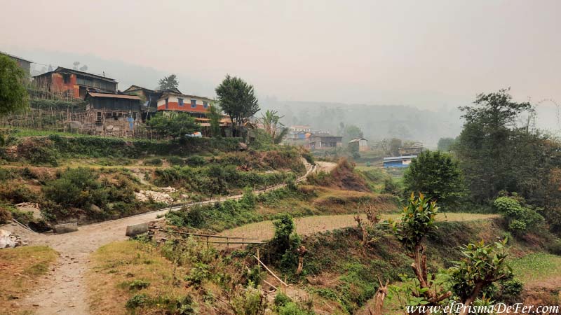
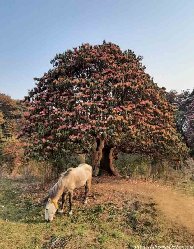
The landscape on this side of the mountain range is quite different from what I had seen on the other side during the circuit. Everything is much greener, and it's clear that this side of the massif has more towns and more life.
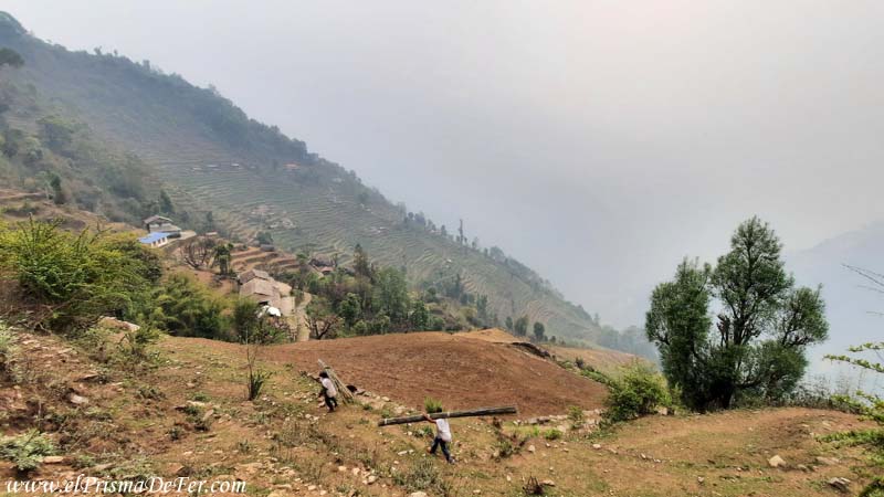
There are terraced fields, forests, and more people coming and going. I also started encountering more trekkers, which makes sense since this section is much more popular than the previous day's.
During these days it also became common for it to rain in the late afternoon and evening, so walking early and keeping a good pace was important to arrive before the downpour. The positive side was that the rain, although annoying, helped to clear some of the smog that had been lingering for days.
Day 3: Chhomrong – Deurali
| Distance |
| 15 km |
| Estimated time |
| 6/8 hs |
| Elevation Profile |
| From 1900 mts to 3200 mts |
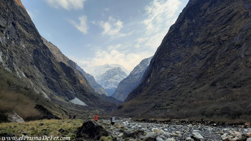
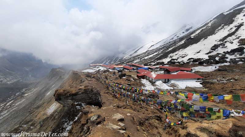
The third day was from Chhomrong to Deurali (3200 m), another long day, about 18-20 km, but very beautiful in terms of scenery.
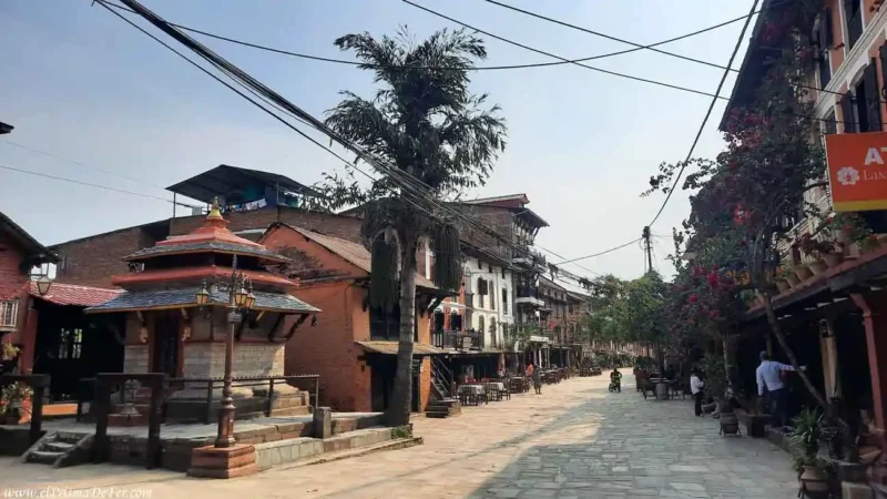
Chhomrong was one of the prettiest villages on the entire trek. Located on the mountainside, it's a large village but maintains a rural feel, with rice terraces and houses scattered across the hillside.
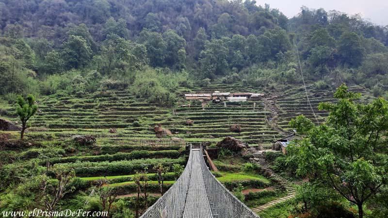
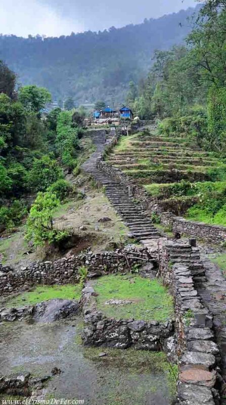
There's usually a checkpoint here where they check your permissions (see on the map), so it's a good idea to have them handy. The town also has a unique feature that will test you right from the start. You have to descend an endless staircase to cross a long suspension bridge, and then climb back up the other side to regain that entire elevation.
The rest of the day follows a similar logic, this time there are more climbs than descents, but always gaining altitude progressively.
The villages that follow are relatively close to each other, making this a very flexible stage. You can adjust your pace as you go and stop at intermediate points like Sinuwa, Bamboo, Dovan, Upper Dovan, or Himalaya depending on how you feel that day.
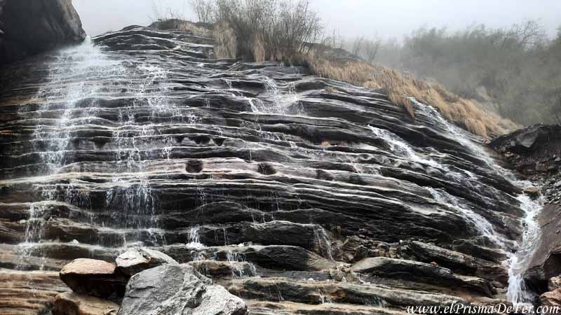
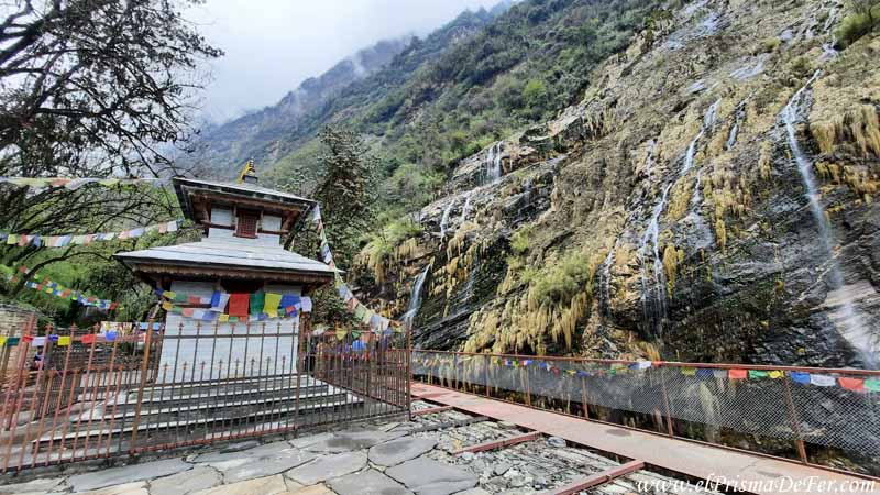
In the final stretch, several waterfalls accompany the path and add to the landscape, visible both from the trail and from the opposite side of the valley.
From this area onwards, the change in prices is also noticeable: they start charging for Wi-Fi, showers, and in general, everything becomes a little more expensive as you gain altitude.
I decided to stretch on to Deurali, which is one of the last settlements before the final leg to base camp. Reaching that far puts you in a better position for the next day, but the truth is that everyone can adjust the stage according to their energy levels and how their body is responding.
Day 4: Deurali – Annapurna Base Camp
| Distance |
| 7 km |
| Estimated time |
| 3/4 hs |
| Elevation Profile |
| From 3200 mts to 4100 mts |
Having slept in Deurali, the last stretch to base camp was a short day: about 3 hours of walking with about 900 meters of elevation gain, but very gradual, so it didn't feel as hard as I expected.
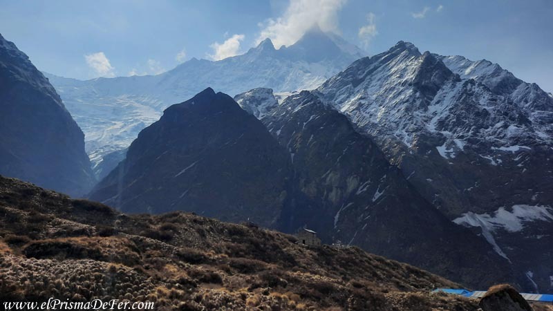
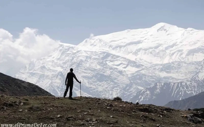
Along the way, Machapuchare (Fishtail) begins to appear strongly, an unmistakable peak due to its shape, which accompanies you in the last kilometers and becomes increasingly imposing.
The smoke that had haunted me the previous days was finally behind me, although now, the other challenge is that Annapurna is known for being frequently cloudy.
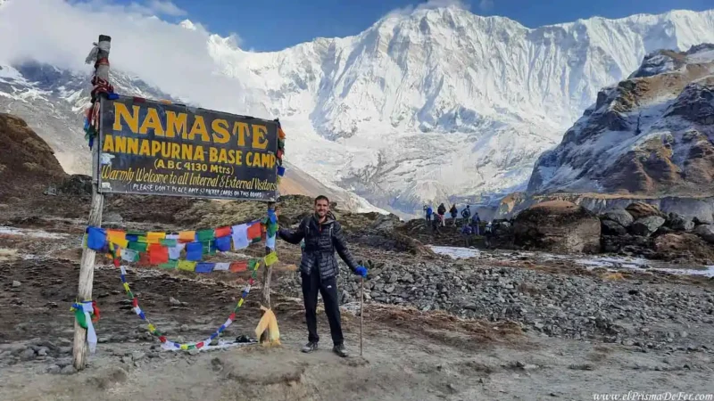
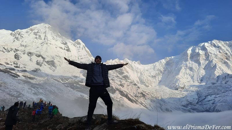
When I arrived at the camp, before noon, the sky was already closing in, so I didn't have a clear view that day, but I already knew that the real spectacle is at dawn.
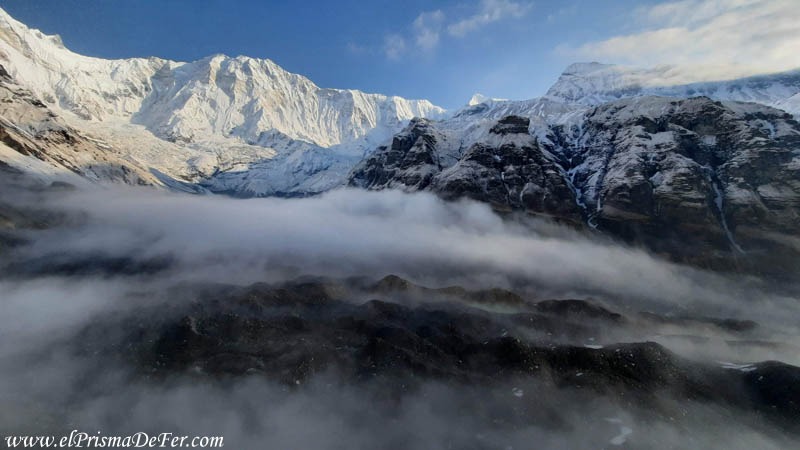
Even so, since I arrived early, I took the opportunity to walk around a bit. Although the clouds were coming and going, the place is spectacular.
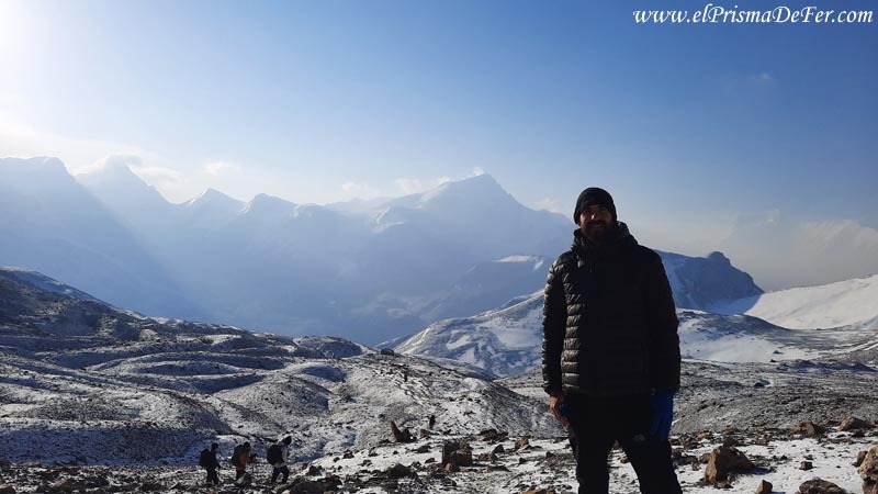
The camp is nestled in a veritable natural amphitheater. Not only do you have the Annapurna massif in front of you, but also a vast valley that was once covered by a glacier.
Today it remains as a great tongue of rock descending through the valley, surrounded by mountain walls that make you feel tiny. Even with partial visibility, the landscape is one of the most breathtaking I've ever seen.
Once at the camp, there's not much to do but rest and wait. As was the case for me in Thorong Phedi during the tour, life revolves around the common room. Outside it's freezing cold, and between the fog and the afternoon wind, it's almost unbearable.
Day 5: Annapurna Base Camp – Chhomrong – Jhinu Danda
| Distance |
| 23 km |
| Estimated time |
| 6/8 hs |
| Elevation Profile |
| From 4100 mts to 1700 mts |
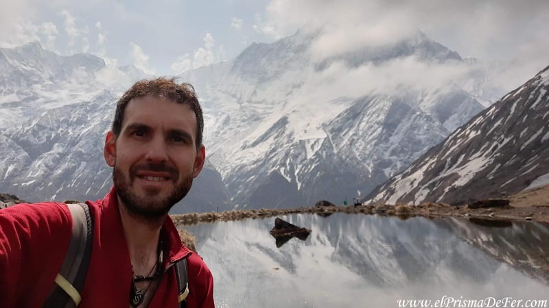
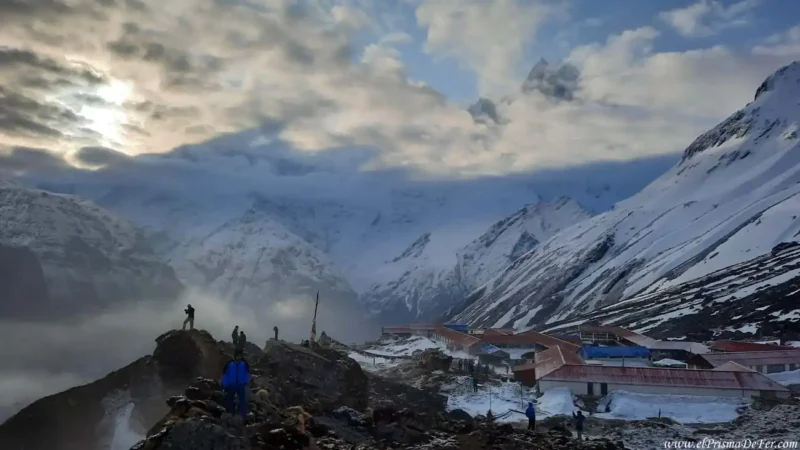
The night at camp was tough. It snowed, it was freezing cold, and I slept poorly. On top of that, I had to get up early that day, no matter what. You have to get up around 5:30 am (depending on the sunrise time) because Annapurna usually offers a very short window of clear sky. After 9 am, sometimes even earlier, it's normally completely overcast.
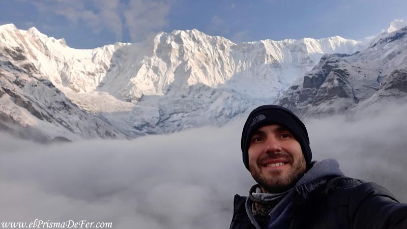
I was lucky enough to catch those two magical hours with no smoke, no clouds covering the peaks, and the massif quite clear. I think, in terms of views, it was the most spectacular I had during my entire trek in the Annapurna region.
I made the most of every minute of the morning, walking back and forth along the natural viewpoint, taking photos and videos, unable to believe what I saw before me. These are the kinds of places that are etched in our memories forever.
That brief dreamlike state was cut short when dark, rain-laden clouds began to roll in, so I had little choice but to begin my retreat before conditions worsened.
Return of the ABC
Unlike the circuit, here you have to return the same way. Descending at a fairly fast pace, I passed through Deurali, Himalaya, and Sinuwa again until I reached Chhomrong. The usual thing to do is stop there, but since I still had energy, I continued down to Jhinu Danda.
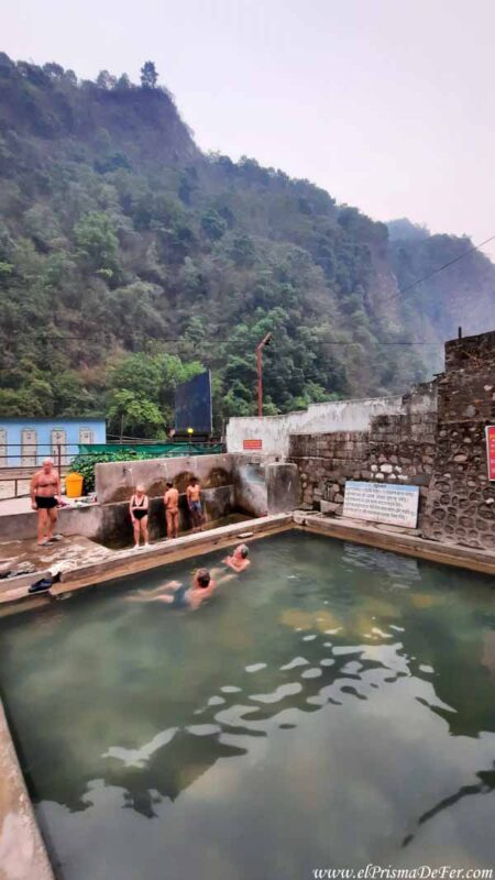
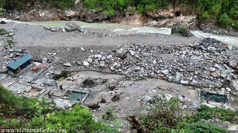
I hiked around 23 km and descended from 4130 m to 1780 m, so the change was immediately noticeable. Less cold, more greenery, and the reward of natural hot springs to soothe my body after the exertion.
The Jhinu Danda hot springs are the perfect ending after several days of hiking. They are located on the banks of the river, about a 20–25 minute walk downhill from the village (see on the map), and consist of several natural hot spring pools.
It was a very long day, but it was completely worth it. I enjoyed the best views of the trek and managed to escape the freezing weather at base camp.
Day 6: Jhinu Danda – Pokhara
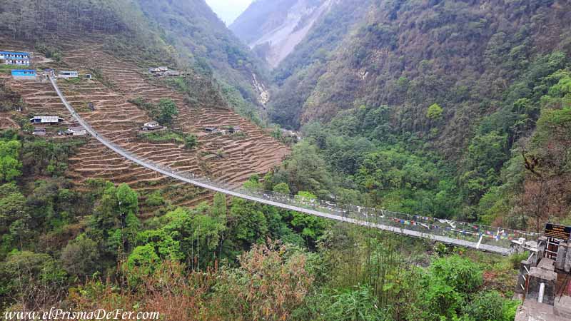
On this last day of the ABC trek, there's practically no walking involved. From Jhinu, you have to cross a very long bridge, one of the longest I saw in the entire region, and on the other side, just a few meters away, is the stop where the buses and jeeps depart for Pokhara (see on the map).
For Nepal, the return trip is short, only about 2.5 hours, and costs around 1000 rupees.
Return to Pokhara
After almost two weeks hiking through this region, returning to the city felt strange. On the one hand, I longed for warmth, a comfortable bed, and some relaxation. But at the same time, I knew I was going to miss the mountains, the villages, and that trekker's life, where the only important things each day are hiking, eating well, and reaching the next refuge.
Although I had no more major treks ahead of me in Nepal, months later I would have the pleasure of continuing my trek in Kyrgyzstan and Georgia, other true paradises for multi-day treks.
Annapurna Circuit vs Annapurna Base Camp: Which trek is better and how do they differ?
Comparing the Annapurna Circuit with the Base Camp trek is interesting because, although they share the same massif, they end up being different landscapes and experiences.
The trek to Annapurna Base Camp seemed more popular and crowded to me. There are more villages, more local life, and a much greener landscape for much of the route.
It feels more "inhabited," with terraced fields, rainforests, and a constant flow of trekkers. In return, the final reward is among the best in the region. Reaching the amphitheater of base camp and being surrounded by that wall of mountains is, for me, one of the most breathtaking views I've ever had in the mountains.
The Annapurna Circuit, on the other hand, felt more remote. There are long stretches where the sense of isolation is greater, the landscape changes considerably over the days, and the route feels more diverse: valleys, arid areas, high-altitude villages, and crossing the pass as the main challenge. It's a more gradual trek, where you see how the environment transforms as you gain altitude.
That's why I can't choose one over the other. They're distinct experiences that complement each other beautifully: the circuit offers variety and a sense of adventure, while the base camp provides a final destination that's hard to beat. If time allows, combining both, as I did, seems to me one of the best ways to truly get to know this region.
Support The Prism of Fer!
Your support helps me continue creating free content on the blog. Thank you so much!