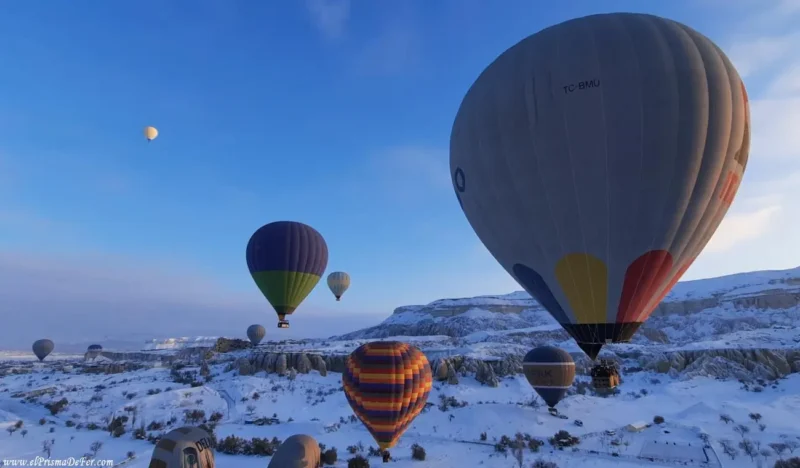
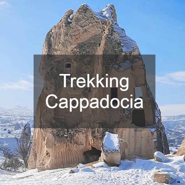
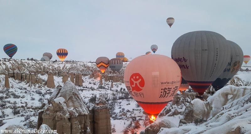
Cappadocia is primarily known for the hundreds of balloons that float over its iconic landscape. What I didn't know before arriving is that it also offers many trails to explore on foot. Trekking in Cappadocia is, without a doubt, one of the best ways to discover the region beyond traditional balloon flights.
Walking through its valleys, crossing rock formations that seem from another planet, and visiting still-inhabited troglodyte villages allows you to authentically connect with the spirit of the place.
In this post, I'll tell you about the most popular and recommended trekking trails in Cappadocia, including their main characteristics, difficulty levels, and what you can expect on each one.
If you like walking and want to see this corner of Türkiye from a different perspective, you'll enjoy every step.
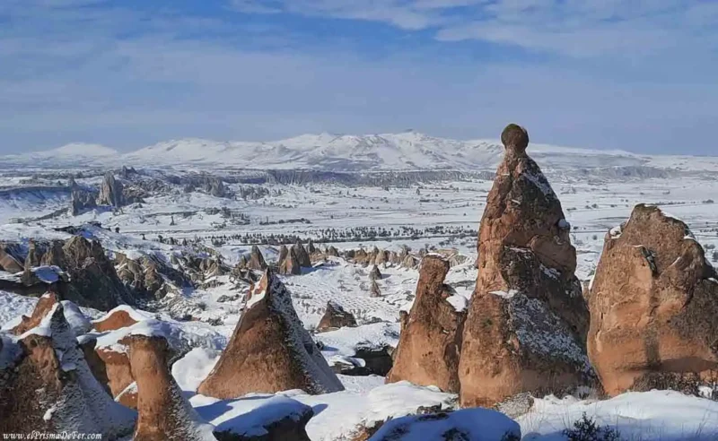

Table of Contents
Where is Cappadocia located?
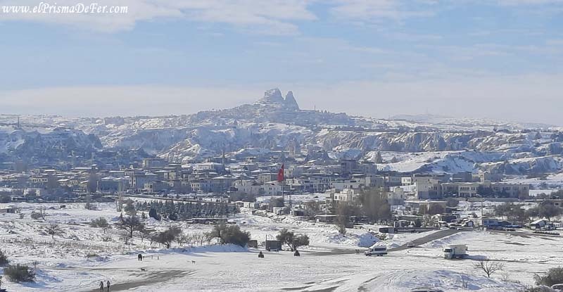
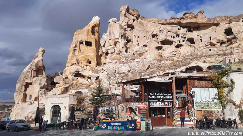
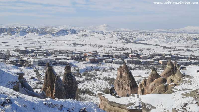
Cappadocia is located in central Turkey, in a region comprised of several towns such as Göreme, Uçhisar, Ürgüp, Avanos, and Ortahisar. It's a unique area for its volcanic landscapes and rock formations known as "fairy chimneys," which seem like something out of this world.
If you want to know more about how to get there, where to stay, what to see, and other useful tips, I recommend reading my other full post on Cappadocia, where I share my experience and all the practical information you need to plan your visit.
Hiking in the snow: a different kind of Cappadocia
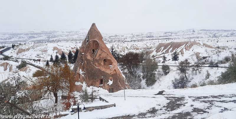
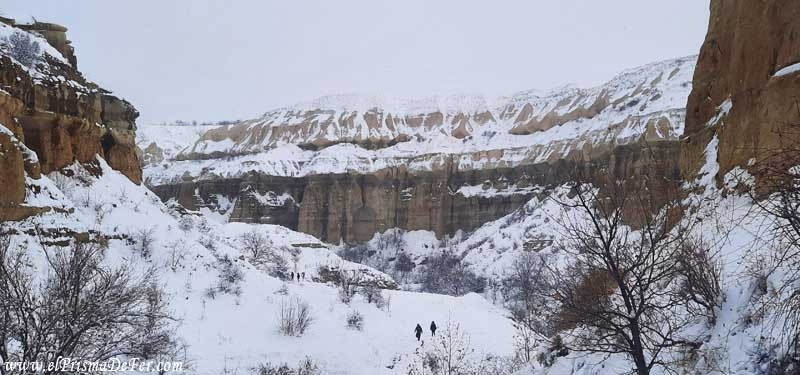
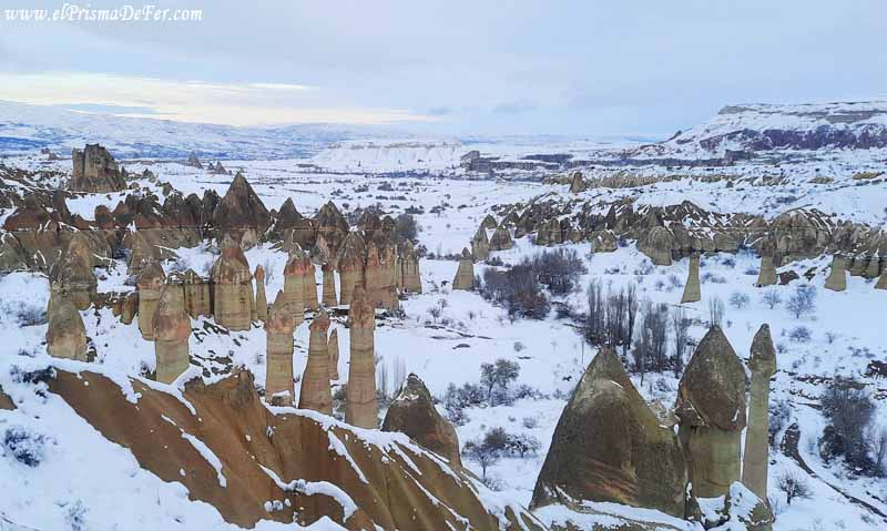
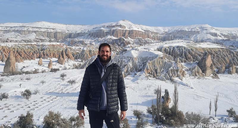
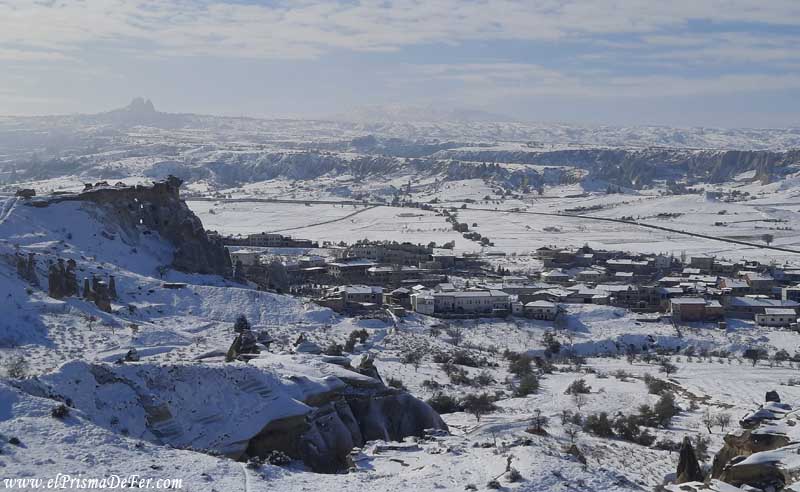
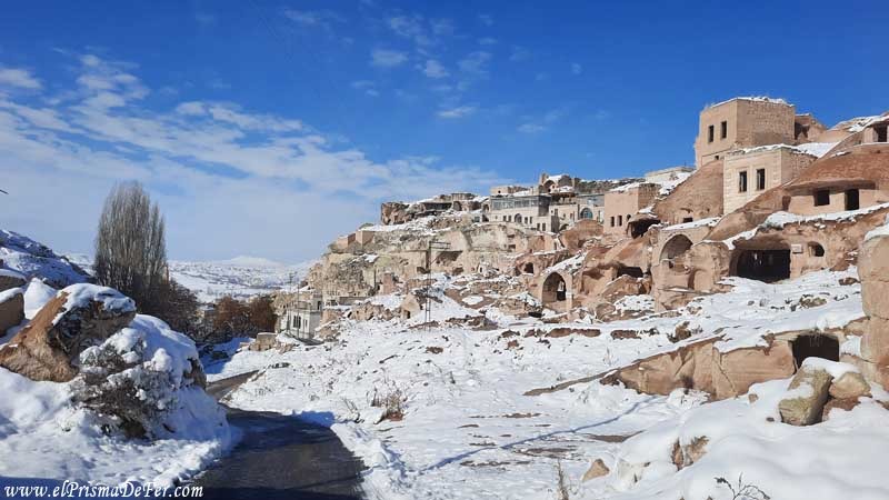
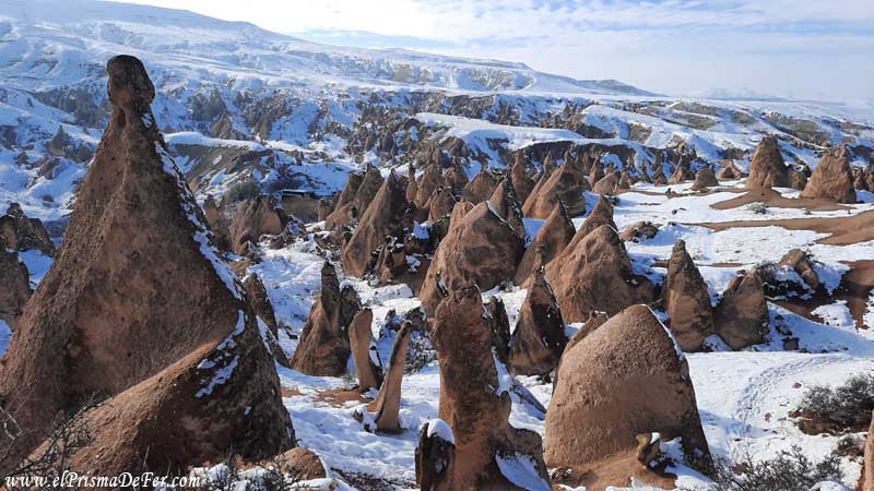
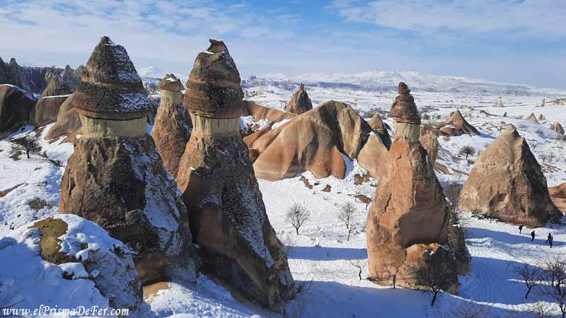
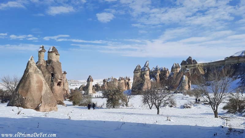
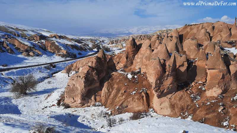
When I trekked in Cappadocia, snow was the star of the show. Except for one day before the snowfall, the rest of the time the landscape was completely covered in white, something that completely changed the way I experienced each trek.
The views of the snow-covered valleys, with their fairy chimneys and rock formations covered in a thin layer of ice, were truly out of this world.
But this unusual beauty also brought its challenges. The cold was constant, and in several sections, the hike required walking through accumulated snow or slippery areas, making the journey slower and more demanding.
Still, it was an incredible few days. The snow gave the valleys an epic and magical feel, and walking in that environment felt like exploring a completely different landscape than the one you usually see in summer photos.

The main hiking trails in Cappadocia
There are several accessible trails in the region, ideal for both those seeking short hikes and those who prefer longer routes.
The trails wind through rock formations, natural tunnels, caves, and viewpoints with breathtaking views.
Below I will mention the ones I was able to do during my days there, which are the best known and recommended: Pigeon Valley, Love Valley, Red and Rose Valley, and the one that connects Göreme with Ürgüp, crossing Monk Valley and Imagination Valley.
Each one has its own unique charm, with completely different colors, shapes, and landscapes, but they all share the same magic that makes Cappadocia a unique place for trekking.
Do you want to follow my routes precisely?
Download the KML/KMZ files of all the trails I hiked in Cappadocia, including Pigeon Valley, Love Valley, Red and Rose Valley, Monk Valley, Fairy Chimneys, and Imagine Valley, and open them in apps like Maps.me or Gaia GPS to view the complete route offline. This is ideal if you want to navigate the valley with confidence, even without a signal.
Get the Cappadocia files from Gumroad for a nominal fee.
Pigeon Valley Trail
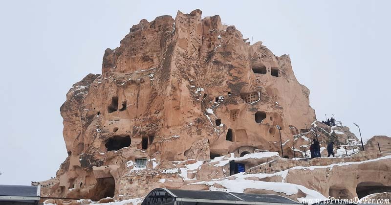
One of Cappadocia's most classic hiking trails begins in Göreme and follows Pigeon Valley, a scenic route that connects the town to Uçhisar, famous for its rock castle that dominates the entire region.
The trail is between 4 and 5 kilometers long and typically takes between 1.5 and 2 hours to complete, depending on your pace and how many photo stops you make.
The trail winds through gentle volcanic formations, rock-cut caves, and countless dovecotes (hence the valley's name).
On clear days, it's one of the most pleasant hikes you can take in Cappadocia: it's not too long, it's full of panoramic viewpoints, and it ends right at the foot of Uchisar Castle.
In my case, the weather didn't help much. It snowed intermittently for most of the hike, making the ground slippery and visibility poor.
While I managed to finish it, it wasn't as enjoyable as it could have been. Still, I can imagine how beautiful it must look in the sunshine.
It's a short walk, but it perfectly captures the spirit of Cappadocia.
This tour can also be combined with the Love Valley tour, as it is very close to Uchisar. Weather permitting, you can continue hiking and connect both valleys for a full day of trekking through some of Cappadocia's most distinctive landscapes.

Love Valley Trail
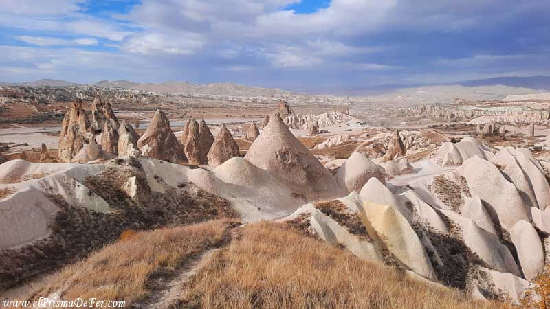
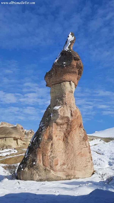
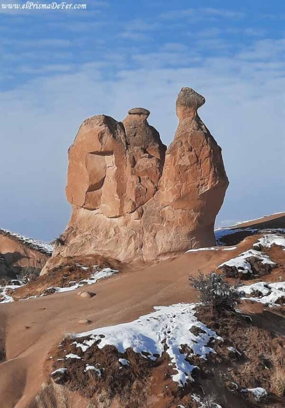
Love Valley is, without a doubt, one of the most photogenic and unique landscapes in all of Cappadocia. Its name comes from the unusual phallic-shaped rock formations that rise up in the valley, the result of centuries of volcanic soil erosion.
Although many people come to the viewpoints just to admire the view, walking around them is a completely different experience.
The main trail is about 4 to 5 kilometers long, and can be done in about 1.5 to 2 hours at a leisurely pace.
The route can be started from either Göreme or Uçhisar, and in both cases it passes through spectacular natural surroundings, with rocky walls, scattered vegetation and the unmistakable silhouette of fairy chimneys.
There are two ways to enjoy the valley: from within, walking along the bottom among the formations, or from above, following the trails that border the canyon and offer panoramic views ideal for watching the sunrise or sunset.
Personally, I recommend doing both if you have time: walking inside allows you to experience the true scale of the rocks, while the viewing points give you a broader perspective of the landscape.
In winter, when I visited, the valley was completely covered in snow, giving it an almost surreal feel. It was very cold, however, and the trail was slippery in places. But with or without snow, Love Valley is one of the places that alone justifies a trip to Cappadocia.
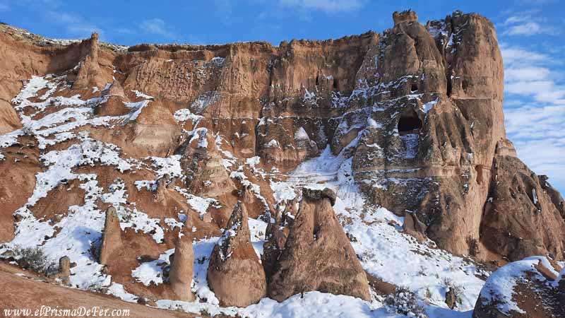
Trails in Red Valley and Rose Valley
Red Valley and Rose Valley are probably the most spectacular trekking areas in Cappadocia. Both are located very close to Göreme and Çavuşin, and the trails actually intertwine, so it's common to hike them together in a single day.
What distinguishes them most are the reddish and pinkish tones of the rocks, which change color depending on the time of day, especially at sunset, when the landscape literally lights up.
The entire route between the two valleys is about 5 to 6 kilometers, and can be done in about 2 to 3 hours, depending on the stops.
The most common starting point is from Göreme, following the signs leading to the Red Valley. Along the way, you can find small rock-hewn churches, such as the Church of the Cross (see location on map), ancient shelters, and natural tunnels that add a touch of adventure to the tour.
One of the best parts of this trek is the opportunity to combine trails. There are more open sections that offer panoramic views of the entire region, and others that are narrower and more labyrinthine, traversing passageways between formations.
In some places, there are even stands selling pomegranate or orange juice, something very typical of the area.
I was lucky enough to see these valleys with and without snow, giving them a completely different appearance, as if they were two different places. But beyond the weather, it's one of the most beautiful landscapes I've seen in Cappadocia.
Under normal conditions, this is a straightforward trek and highly recommended even if you don't have much experience.
The Red Valley End Viewpoint, near the village of Çavuşin, is one of the best places in all of Cappadocia to watch the sunset.
If you have time, staying until the sun sets among the formations is the best possible way to end the day.
Trail from Göreme to Ürgüp, crossing Monk Valley, Fairy Chimneys and Imagine Valley
This Cappadocia trek is an extensive route that takes you through some of the region's most iconic valleys, including Red Valley, Rose Valley, Cavusin Valley, Monk Valley, and Imagine Valley.
The route is flexible, so you can do it all at once or split it up over several days, stopping anywhere to explore, rest, or even return to the village if you prefer.
From Göreme to Çavuşin
The trek to Monk Valley (Paşabağ) and Imagine Valley (Devrent) was, without a doubt, one of the longest and most complete treks I did in Cappadocia.
I started from Göreme, and the first section took me to Çavuşin, again crossing part of the Red and Rose Valley.
The hike to Çavuşin Castle is a beautiful experience in itself, with panoramic views and paths surrounded by formations that look like natural sculptures.
Heading to Monk Valley
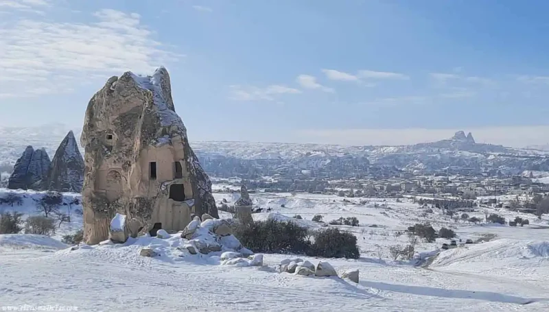
From Çavuşin Castle, the trail turns to the right and begins to walk away from the village. From there, the landscape changes completely: you enter a valley that seems straight out of a fantasy story.
It's a little-traveled path, and you'll likely be walking it almost alone. The trail runs along a mountain and crosses rock formations that, at times, resemble human figures in robes, giving rise to the name “Valley of the Monks”.
The views from this area are truly spectacular. You'll want to stop every now and then, not only to rest, but also to admire the scenery in silence.
On top of that, seeing it covered in snow made everything even more surreal.
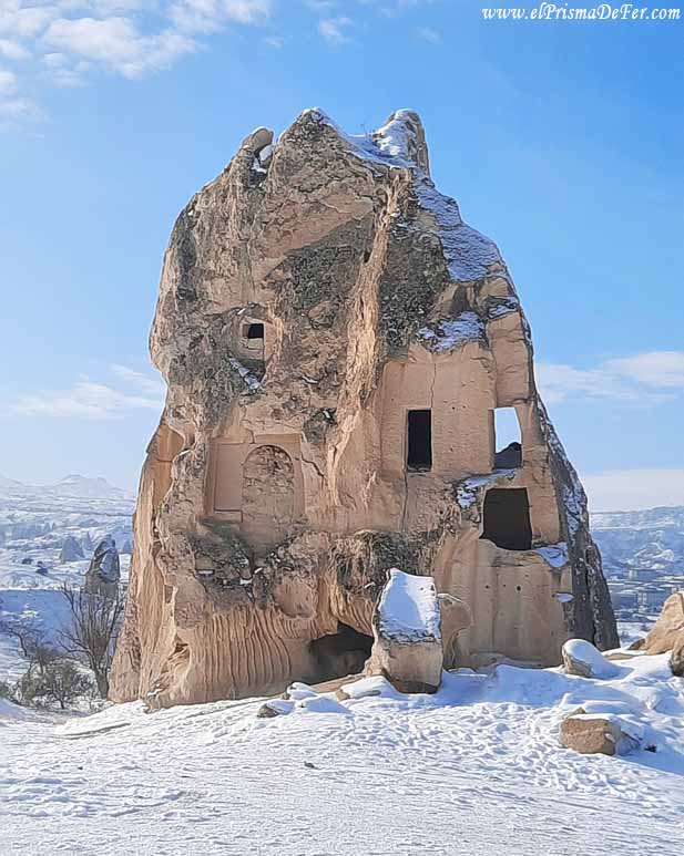
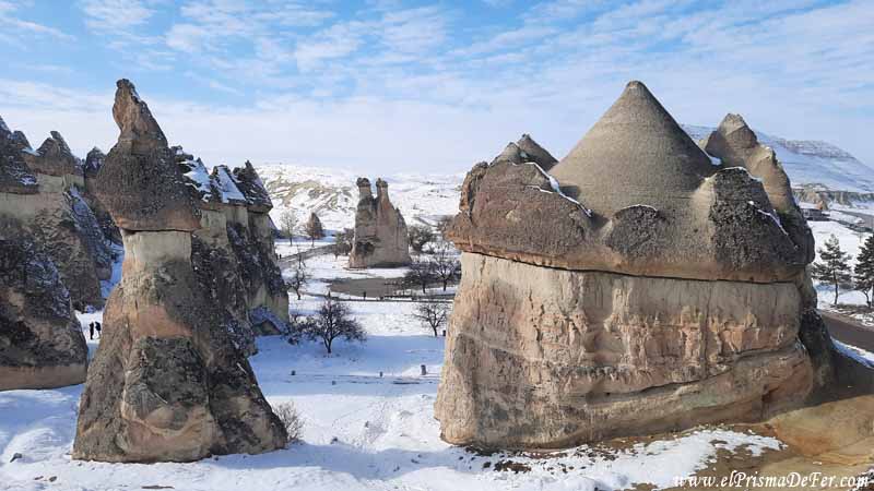
The Fairy Chimneys
If you continue walking, the path reaches the attraction known as “Fairy Chimneys”, one of the most famous in Cappadocia.
The interesting thing is that you can enter from a rear section, not through the official entrance where the turnstiles and ticket office are located. This way, you can enter without paying and freely explore the formations.
The site isn't very large, but it is very picturesque. The eroded rock columns, with their darker stone "caps" at the top, are a spectacle in themselves.
It's easy to understand why this place became one of the most iconic images of the entire region.
Road to Imagine Valley
From there, you can choose to return to Göreme or continue towards Imagine Valley (Devrent). Although it's a little further away, a few more kilometers of hiking, it's still perfectly reachable on foot.
To get there, you have to leave the park through the main entrance (don't worry, no one controls the exit) and follow the path to the right.
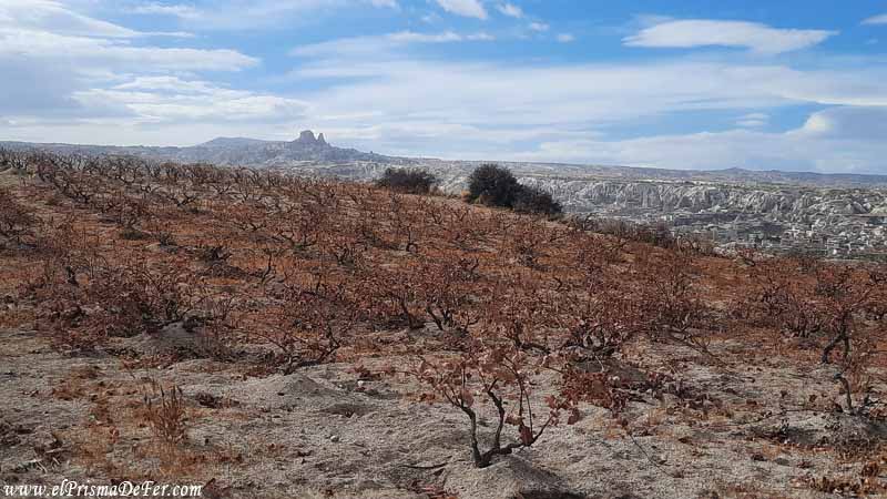
Imagine Valley (Devrent)
Imagine Valley, also known as Devrent Valley, is a place that lives up to its name. Unlike other, more well-trodden valleys, this one has no carved-out churches or marked trails; What makes it special are its rock formations with whimsical shapes, which seem to come straight from the imagination.
Just a little observation is enough to begin to distinguish animal figures, human faces or fantastic creatures.
Being a little further away from Göreme, it doesn't receive as many tourists. Most people stop for just a few minutes at the viewpoint by the road, take a few photos, and continue on their way.
But if you take the time to enter among the rocks, the landscape becomes even more fascinating. The shapes seem to multiply as one walks, and on more than one occasion I had the sensation of being surrounded by stone giants watching over the valley.
From here, there are two options: return to Göreme or continue the route towards Ürgüp, another of the important towns in the region. The distance is already considerable in both directions, so it's worth evaluating your remaining energy.
I decided to continue walking, enjoying the surreal landscapes that could be seen on both sides of the road.
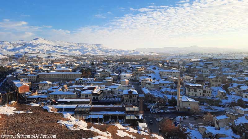
Ürgüp
After several kilometers, a car stopped and offered to take me to Ürgüp, saving me a good stretch and some effort.
Once there, it was worth taking a walk: the town has beautiful viewpoints, caves carved into the rock and a much more local atmosphere, although less picturesque than Göreme.

As it was already evening, I was only able to explore part of the city, but I left with the feeling of having completed a spectacular journey, full of contrasts and unique landscapes.
From Ürgüp it is also possible to walk back to Göreme, completing a phenomenal circuit of valleys and kilometers, but I preferred to take a dolmuş from the station to return to the town before nightfall.
Best time to go trekking in Cappadocia
Cappadocia can be visited year-round, but the experience varies greatly depending on the season.
Spring (April to June) and Autumn (September to November) are undoubtedly the best times to go trekking. The temperatures are pleasant, the days are usually clear, and the landscapes are just right: green and vibrant in spring, or tinged with ochre and gold in autumn.
In summer, the heat can be quite intense, especially at midday, so it is a good idea to leave early and bring enough water.
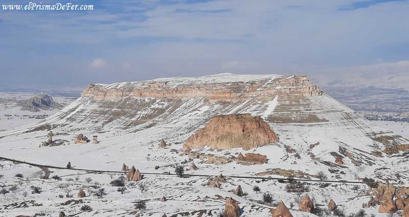
If you go in winter, the hikes have their own particular charm: the snowy valleys give a magical and different air to the landscape, although they also make some trails more slippery or difficult to follow, in addition to the cold that is very present at this time.
In short, if you want to enjoy the trails to the fullest without suffering from the weather, spring and autumn are your best allies. But if you like peace and quiet and don't mind the cold, winter will give you a completely different view of Cappadocia, almost devoid of tourists.
Tips for hiking in Cappadocia
Hiking in Cappadocia doesn't require extensive preparation or professional equipment, but it does require some tips to help you enjoy it to the fullest.
- The trails can generally be hiked in just a few hours, so there's no need to bring camping gear or much food. Most paths pass near villages like Göreme, Uçhisar, Çavuşin, or Ürgüp, where you can easily rest, eat, or get water.
- Bring good trekking shoes (the trails may have slippery areas or loose stones) and sun protection, because there are sections without shade.
- In the colder months, warm, layered clothing is essential, as the weather can change quickly and winds can be strong.
- If you're going alone, download an offline map from Maps.me or AllTrails beforehand, as not all trails are marked.
- And something that seems obvious but many forget: start early. This way you'll avoid the heat (if you go in the summer), have better lighting for photos, and can walk more freely.
Final thoughts
Before arriving, I had no idea that Cappadocia had so many hiking trails, let alone that they were so accessible.
I was surprised to discover that you can hike for just a few hours, through valleys filled with unreal rock formations that look like something out of a fantasy story. And the best part is that you don't need to be a great adventurer or have any mountain experience; the trails are close to the villages and easy to follow.
It was one of the things I enjoyed most about Cappadocia, besides the balloon flight, because it allows you to see the most natural and surreal side of the region, without the crowds.
Walking among those unique landscapes, lost among caves and rock formations with strange shapes in the surroundings, was an experience that I not only loved, but also left me wanting to return someday to continue exploring.
Support The Prism of Fer!
Your support helps me continue creating free content on the blog. Thank you so much!