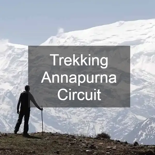
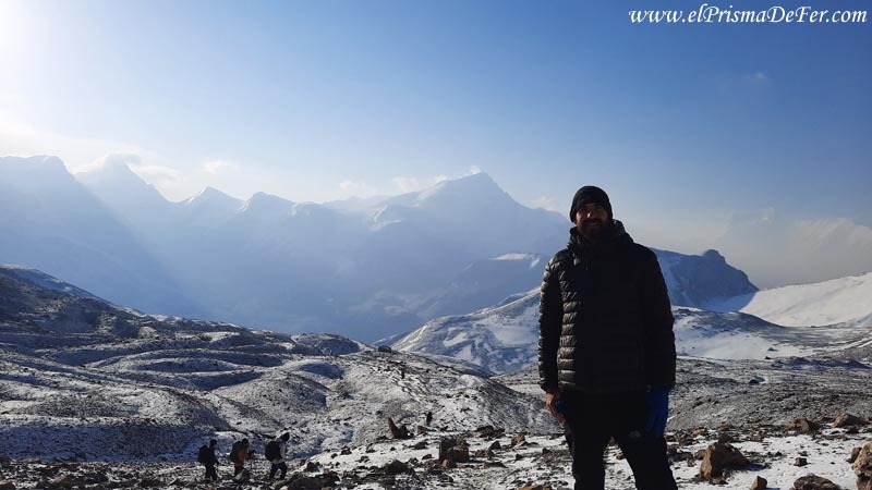
Among the vast number of trails that Nepal offers, the Annapurna Circuit is one of the most outstanding, and it is not by chance that it is considered one of the most beautiful and famous treks in the world.
It is a very complete trek where each day brings something new, you cross valleys, mountain villages and high passes where the landscape is constantly changing.
This variety ensures that the journey never becomes monotonous and that you always have the feeling of discovering something different as you round each bend in the valley.
In this post I'll tell you about the complete circuit as I did it on my own: stages, feelings, challenges, details of the route and practical advice, so you have an idea of what you'll find if you decide to do it.

This post may contains affiliate links. If you purchase through these links, I may earn a commission at no extra cost to you. Thank you for your support!
Table of Contents
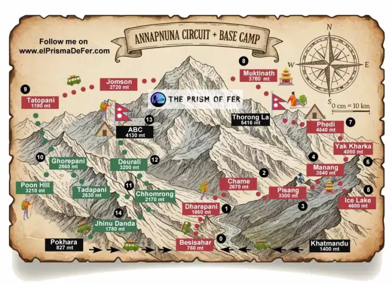
🗺️ Technical sheet for the Annapurna Circuit trek
| Start |
| Tal, almost Dharapani |
| Final |
| Muktinath and bus to Tatopani |
| Duration |
| 9 days |
| Distance |
| ~100 km |
| Accommodation |
| Teahouses |
| Max. Altitude |
| 5416 mts |
| Difficulty |
| Moderate |
| Signaling |
| Good |
| Water/food |
| In every town |
Do you want to follow this route precisely?
Download the KML/KMZ file of my Annapurna Circuit trek and open it in apps like Maps.me, AllTrails, or Gaia GPS to have the complete route offline. Ideal if you want to navigate the valley with confidence, even without cell service.
Download the Annapurna Circuit on Gumroad for a low cost. You can also download the base camp trek or even take advantage of the both kit for a better price.

Why did I choose the Annapurna circuit and not the Everest circuit?
When I started planning my trip to Nepal, I hesitated quite a bit between doing the classic trek to Everest Base Camp and the Annapurna Circuit along with Base Camp.
In the end, I opted for Annapurna because I was more drawn to the idea of a varied trek than a simple out-and-back hike to the same spot. The circuit takes you through valleys, villages, climates, and landscapes that are very different from one another, and the final panoramic view from ABC (Annapurna Base Camp) is spectacular.
Logistics also played a role. Annapurna is more flexible, cheaper, and less dependent on domestic flights. You can adapt it to your schedule, enter and exit through different points, and manage your pace more freely.
For my first trek in Nepal, it seemed like the perfect combination of challenge, accessibility, and diversity. After completing it, I confirmed it was the right choice to start with.
How to organize a trek through the Annapurna Circuit
To avoid cramming too much information into one place, I've created a separate post explaining in detail how to organize your trek step by step: permits, transportation, budget, equipment, and all the pre-trip logistics. It contains everything practical you need to know before you start.
This article focuses on the tour and the experience itself, while the complete organizational guide can be found in that other post.
Detailed itinerary of my experience on the Annapurna Circuit
Day 1: Pokhara → Besisahar → Tal → Dharapani
| Distance from Tal |
| 7.7 km |
| Estimated time |
| 2/3 hs |
| Elevation Profile |
| From 1700 mts to 1860 mts |
On the first day I started very early, leaving from my hostel Pokhara Backpackers Hostel towards the New Bus Park terminal (see on the map), from where the buses depart that connect Pokhara and Besisahar on a journey of about 4 hours.
You can't book in advance, so I recommend arriving early to secure a spot on the bus.
Besisahar
Besisahar is a small town that serves as the main traditional access point to the Annapurna Circuit. It's a transit point, without major tourist attractions, but very convenient since jeeps depart from here to the valley villages, such as Dharapani, Chame, or even Manang. You can also find shops selling equipment in case you've forgotten any clothing or accessories.
Once in Besisahar, I had to wait a while for the shared jeeps to arrive. When they asked me how far I wanted to go, I told them to drop me off at Tal, a small town located about 7 km before Dharapani.
I had read experiences from other travelers who commented that the first stages, between Besisahar and Dharapani, are not among the most scenic of the route, and since I also did not want to unnecessarily lengthen the trek, as my idea was to combine this circuit with the Annapurna Base Camp, I preferred to save days in this part and focus them on the sections that interested me most.

Of all the people who arrived in Besisahar, the vast majority didn't start the trek there, but preferred to continue several stages to Dharapani or Chame. This flexibility is part of how the Annapurna trek is done today, where everyone creates their own starting point.
Tal
Tal is a small village located in the lower part of the valley, next to the river. From the jeep route, you first have to go down, cross a bridge, and walk through the village, which is short and very quiet, before crossing another bridge to rejoin the main road.
It's not the most picturesque village on the circuit, but being located next to the river, in the lower part of the valley and surrounded by stone walls, it gave me a first glimpse of what I would find further on.
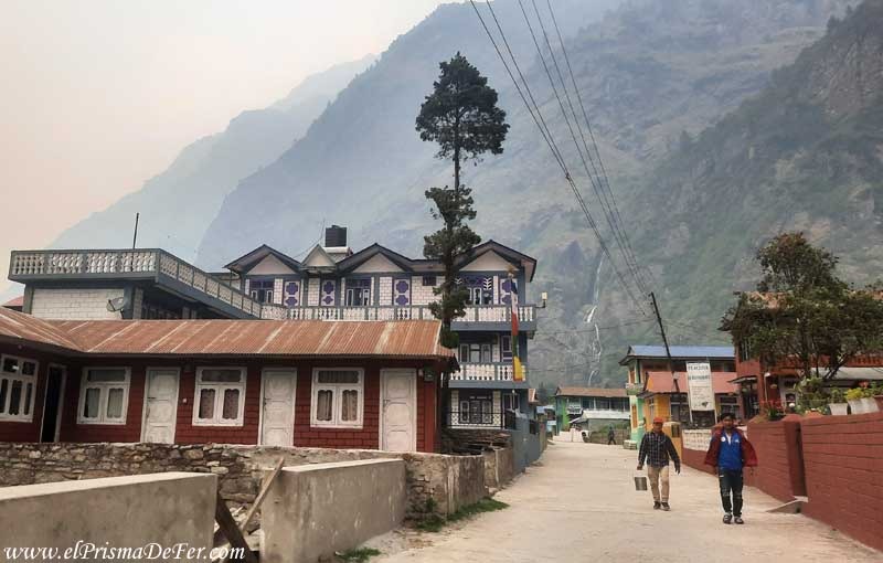
Dharapani
From Tal I walked to Dharapani, about 7 km, where I spent my first night of the circuit. It's also a small village, with just a few houses along the road, but it worked well for resting on this day.
I liked this beginning because it was like a gentle warm-up, a calm stage for the body to get used to the rhythm.
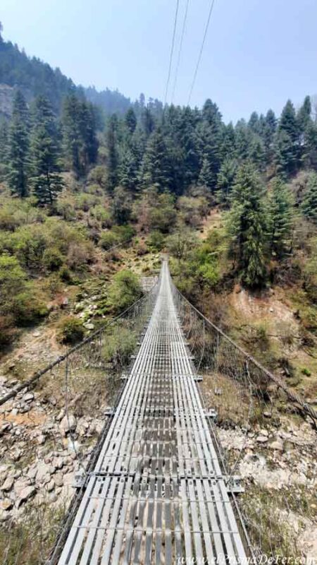
As soon as you set foot on the path, you are immersed in the valley, walking between rivers, rock walls and the famous suspension bridges, which at first give you a bit of vertigo, but after a few crossings you end up getting used to it.
It was a perfect way to get into trekking mode without starting abruptly.
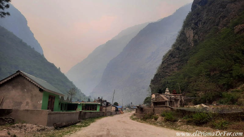
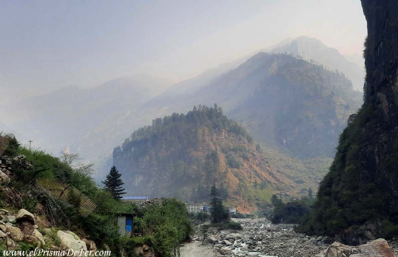
Smoke in the valley
That first day I also encountered the smoke I had seen in Pokhara. I didn't think it would be so prevalent in this area as well, but there it was. A kind of mist that obscured the highest mountains around the valley.
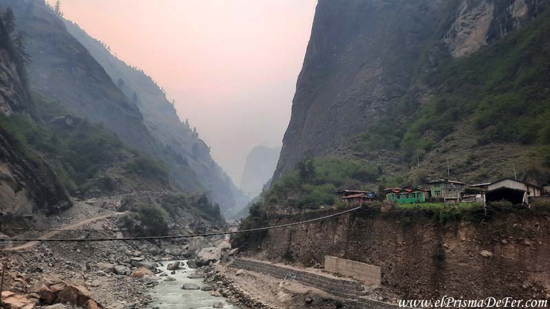
It wasn't bad enough to ruin the hike, but it did slightly obscure the view. Unfortunately, it was going to be with me for a couple more days of the trek.
Day 2: Dharapani → Chame
| Distance |
| 14 km |
| Estimated time |
| 6/7 hs |
| Elevation Profile |
| From 1860 mts to 2670 mts |
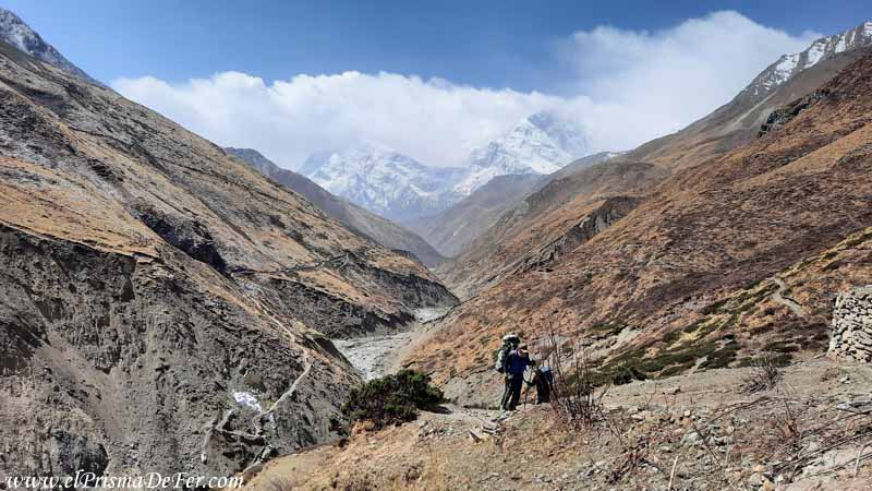
The second day was from Dharapani to Chame, and it was a stage I really enjoyed. The trail continues through the valley, always accompanied by the river, lush green vegetation, and more suspension bridges that were beginning to feel like part of the landscape.
There is a point on the road, after a wide bend in the valley, where you begin to see Annapurna III, one of the secondary peaks of the massif, peeking out from among the mountains. It was my first glimpse of one of the mountain range's summits and one of the moments I remember most vividly.
The climb is gradual until reaching Chame, at 2,610 meters, where the change in temperature begins to be noticeable. The air is cooler, and at night the cold is much more pronounced than on the first day.
Chame, besides being one of the important towns on the circuit, has an interesting bonus if you arrive with some energy. It has natural hot springs located a few minutes' walk from the center. Although it's not essential, if the weather is nice, it might be worth taking a break before continuing your journey.
I actually stayed a little before arriving in Chame, at the New Mount View Hotel & Restaurant, because the town itself didn't quite win me over. I found it quite hectic and with a lot of traffic, so when I arrived I decided to backtrack a bit and stay at this accommodation, which is more secluded and peaceful.
Day 3: Chame → Upper Pisang
| Distance |
| 14 km |
| Estimated time |
| 6/7 hs |
| Elevation Profile |
| From 2670 mts to 3300 mts |
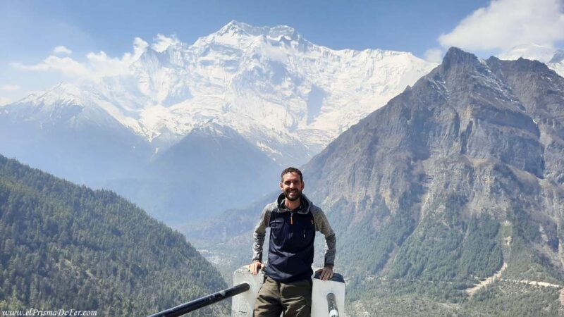
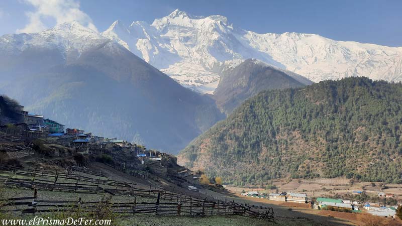
On the third day I walked from Chame to Upper Pisang, another stage I really enjoyed. As you gain altitude, the landscape begins to transform. Less dense vegetation, more exposed rock, and increasingly open panoramas.
Upper Pisang is already at 3,300 meters, and you can feel yourself gradually entering a more high mountain environment.
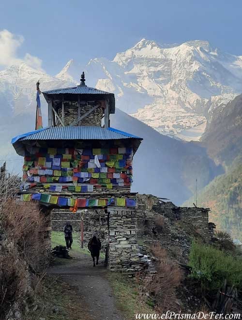
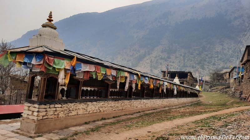
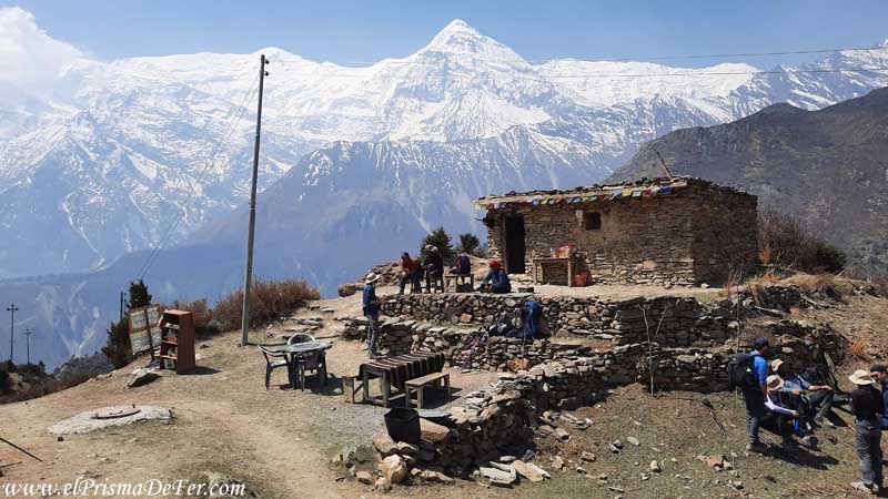
The village was one of my favorites on the entire tour. It has a medieval feel, with stone houses, narrow alleyways, cows roaming freely, and a beautiful Buddhist temple atop a hill, surrounded by prayer flags that are present in every corner.
Despite the spectacular surroundings, the smoke that had been trapped in the valley was still there that day, making many views less than clear. Even so, the place had an incredible atmosphere, and I thoroughly enjoyed walking around the village.
I stayed at the Hotel Nirvana, which is one of the first hotels you come across when you arrive in town. It has stunning views of the valley.
Day 4 – from Upper Pisang to Braka
| Distance |
| 18 km |
| Estimated time |
| 6/7 hs |
| Elevation Profile |
| From 3300 mts to 3400 mts |
I was lucky that it rained heavily that night. That helped clear the air and finally get rid of that damn smoke.
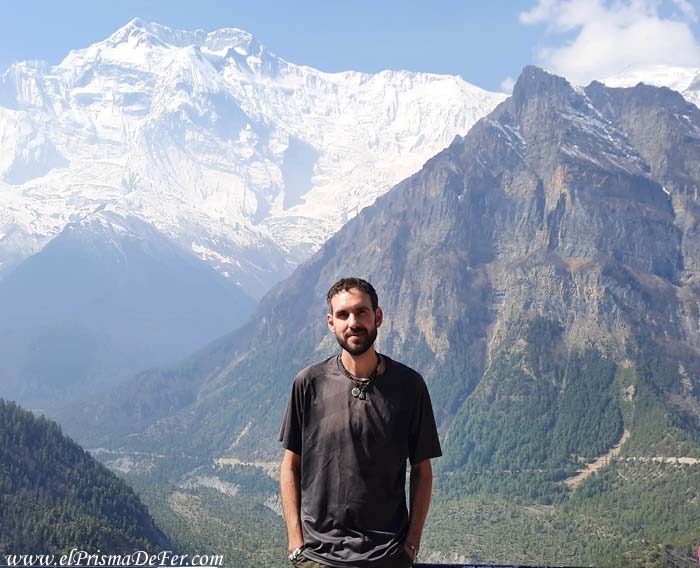
The next morning, as I began my day of hiking, I found the massif completely clear in front of me.
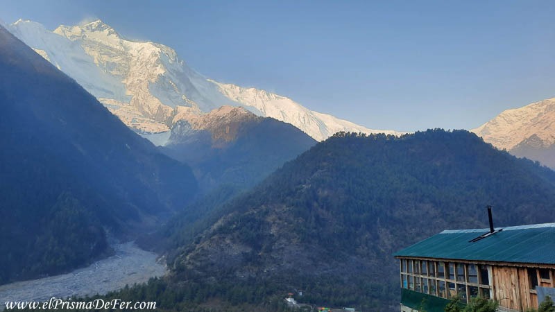
For the first time, I could see Annapurna III with perfect clarity—it was truly imposing. It was a moment that moved me deeply… I almost cried, to be honest. I couldn't help but thank Mother Earth for gifting me with that view, which until now had been obscured by smoke.
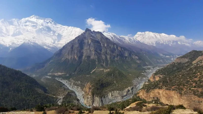
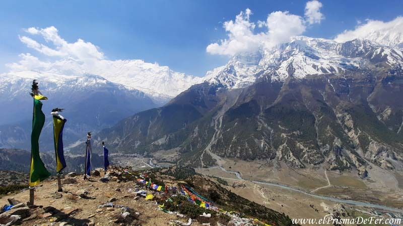
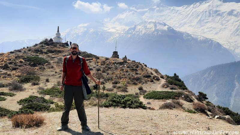
From a scenic point of view, it was one of the most beautiful stages of the circuit for me. Halfway through, after a long and steep climb, you pass through Ghyaru, a small village with a white stupa and a viewpoint that looks like something out of a movie.
From there you can appreciate the valley in its fullness, the snow-capped peaks dominating the horizon and the river that shaped this entire geography.
It was one of the highlights of the entire trek, and I recommend stopping there for a while to rest and just look around.
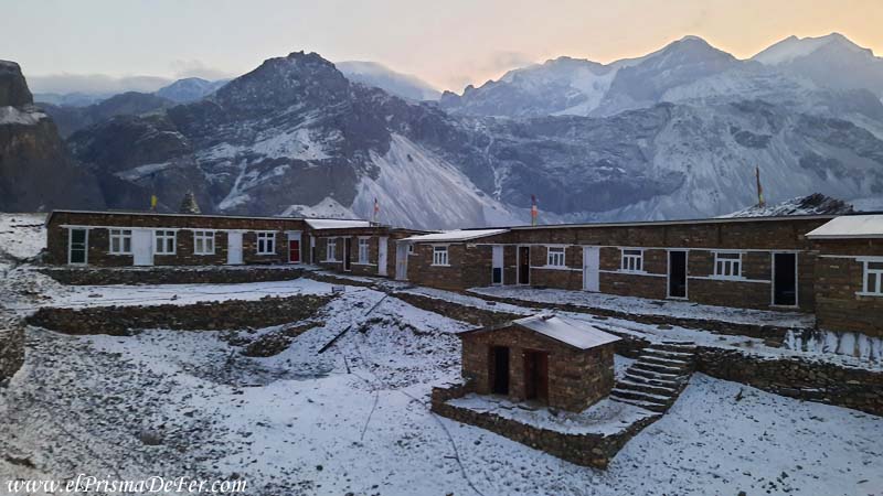
At this stage, the usual route is to continue to Manang, but I preferred to stop earlier and spend the night at the Hotel New Yak in Braka, a village located a few kilometers back. It's a strategic point to use as a base for the next day's acclimatization hike to Ice Lake.
Day 5: Acclimatization trek to Ice Lake and Manang
| Distance |
| 13.7 km |
| Estimated time |
| 5/6 hs |
| Elevation Profile |
| From 3400 mts – 4600 mts – 3540 mts |
I dedicated this day entirely to an acclimatization trek, hiking to Ice Lake, which is about 4600 meters high, starting from Braka at 3400 meters.
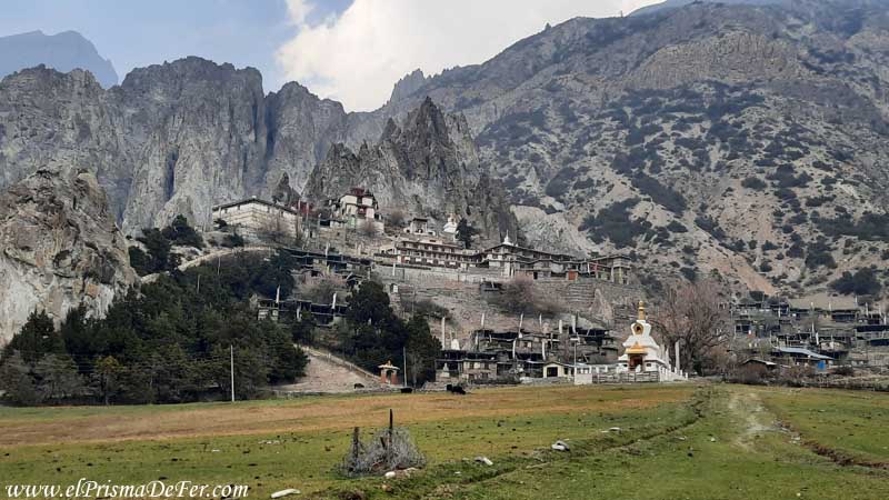
Before starting the climb, I also took the opportunity to visit a Buddhist Monastery, located on a small hill just above the village. Inside, it looks somewhat abandoned, but it retains an authentic feel, with murals, prayer flags, and views of the valley.
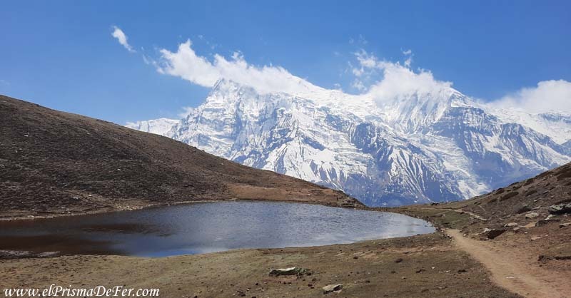
Ice Lake
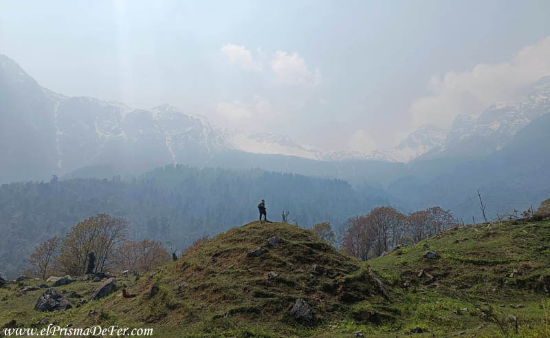
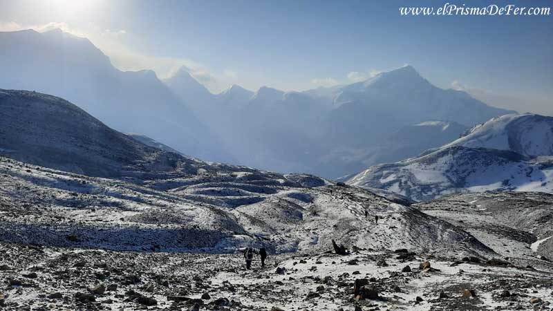
The trek to Ice Lake is a demanding climb, but highly recommended to help your body acclimatize to the altitude before the tougher days of the circuit. What's more, the effort is quickly rewarded, as for almost the entire ascent you have the enormous massif directly in front of you, dominating the landscape, with views you'll never tire of admiring.
It's about a 4- to 5-hour steady climb from Braka or Manang, gaining over 1000 meters of elevation in a short time. The trail is steep from the start and offers almost no respite, but it's well-marked.
The lake, depending on the time of year, can be partially or completely frozen, hence its name. But more than the lake itself, which sits on a kind of plateau surrounded by mountains, the most beautiful thing is the surroundings, the landscapes, and the acclimatization process.
Upon returning in the afternoon, I decided to leave Braka and walk to Manang, where I spent the night, now better acclimatized and ready to continue gaining altitude in the following days.
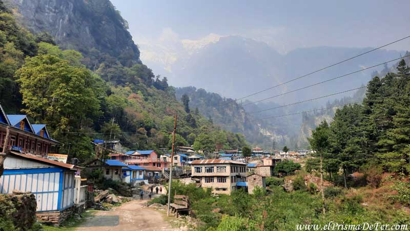
Manang
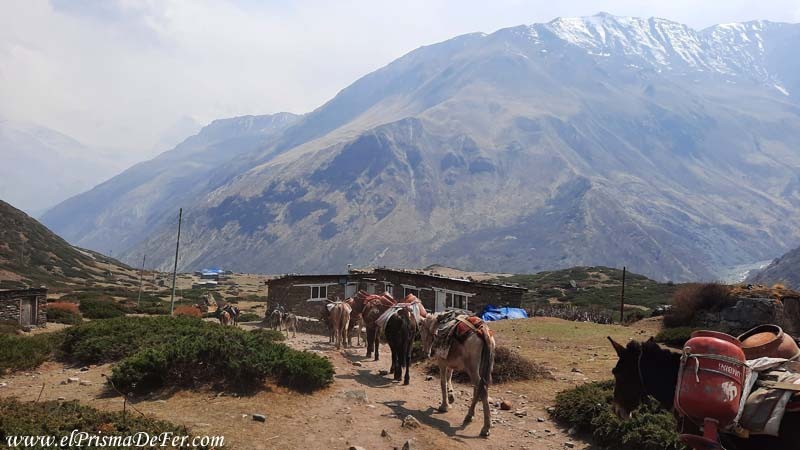
Manang is one of the largest towns on the entire circuit, and it shows right away. There's a wide range of hotels, cafes, bakeries, and several shops selling clothing and trekking equipment in case you need to restock anything at the last minute.
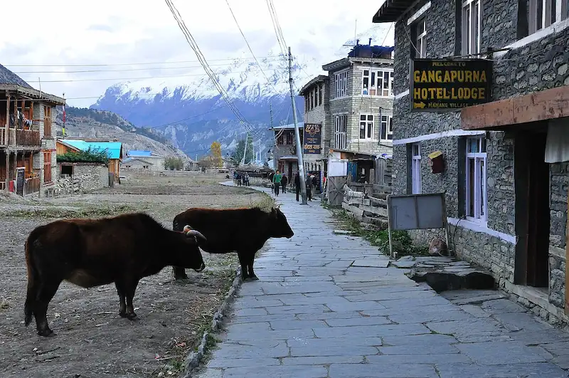
As the jeeps arrive here, there is also more activity than in previous days: trekkers starting, others returning, porters, guides... it is a meeting point before entering the highest part of the route.
Day 6: Manang – Yak Kharka
| Distance |
| 9.5 km |
| Estimated time |
| 4/5 hs |
| Elevation Profile |
| From 3540 mts to 4050 mts |
It was a relatively short day, about 4 hours of walking from Manang to Yak Kharka, but already entering the high altitude zone.
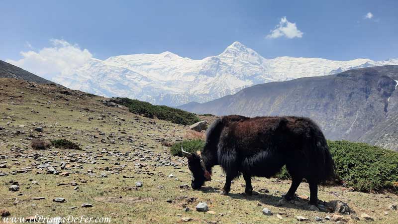
Here we reach 4100 meters and the change in the landscape is already noticeable. There is no vegetation whatsoever, the terrain is arid, and the surroundings begin to feel more exposed. The Annapurna peaks that had accompanied me the previous days are now receding into the distance, and the valley takes on a different shape.
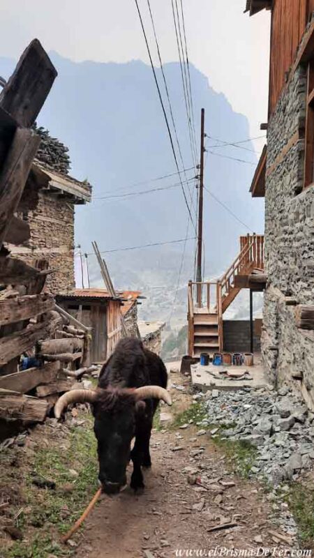
The most striking thing about the day was seeing yaks for the first time on the trail. They appear grazing at these altitudes where it seems nothing could survive, and they complete the remote feel of the place.
It's a relatively easy stage in terms of distance, designed precisely to continue acclimatizing, but it already gets you mentally prepared for what's to come, which is the highest part of the circuit.
I stayed at the Hotel Gangapurna, one of the first options in the village.
Optional detour: Manang – Tilicho Lake (5000 m)
| Distance |
| 20 km |
| Estimated time |
| – |
| Elevation Profile |
| From 4050 mts to 4200/5000mts |
After Manang there is the option of taking the detour to Tilicho Lake, one of the highest lakes in the world, at about 5000 meters above sea level.
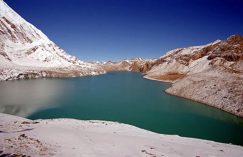
I didn't do it myself, but many trekkers I spoke to agreed that it's one of the most worthwhile variations of the circuit, both for the scenery and the feeling of being in an extreme environment. But keep in mind that it's demanding and adds at least an extra day to the itinerary, as well as involving greater physical exertion at altitude.
The detour begins by leaving Manang to the left, following a different valley than the main circuit. You'll spend the night at Tilicho Base Camp (4200 meters). The next day, you'll set off very early to reach the lake, and from there you can rejoin the classic route at Yak Kharka and continue towards Thorong La Pass.
It's an interesting alternative if you have time, good acclimatization, and a desire to add another challenge to the circuit.
Day 7: Yak Kharka – Thorong Phedi
| Distance |
| 7.4 km |
| Estimated time |
| 2-3 hs |
| Elevation Profile |
| From 4050 mts to 4540 mts |
The last day before crossing the pass was the shortest of all; I walked for about two hours to the Thorng Phedi Hut, at about 4,500 meters. The idea is precisely to avoid overexerting myself and to arrive with energy for the following day.
At this altitude, the weather is already cold (even during the day), with constant winds and a rather harsh atmosphere. This was the first day I felt the effects of the altitude, a slight feeling of being slightly puffy, but nothing to worry about.
From Phedi there is the option of climbing to a higher refuge, the High Camp, to shorten the hike the next day, but this also means sleeping at a higher altitude, with colder temperatures and a greater risk of altitude sickness hitting hard.
I preferred to stay below and try to rest a little better, to tackle the Thorong La crossing from there, prioritizing acclimatization over gaining a few extra meters.
This day in Thorong Phedi felt long, not because of the hike itself, but because the hours just dragged on. Arriving relatively early, I had the whole afternoon ahead of me, but there wasn't much to do in the surrounding area; the cold and wind were constant and pretty much discouraged me from going for a walk.
In the end, most of the time is spent sheltered inside the refuge, resting, talking with other trekkers, eating something hot and trying to warm up while mentally preparing for crossing the pass the next day.
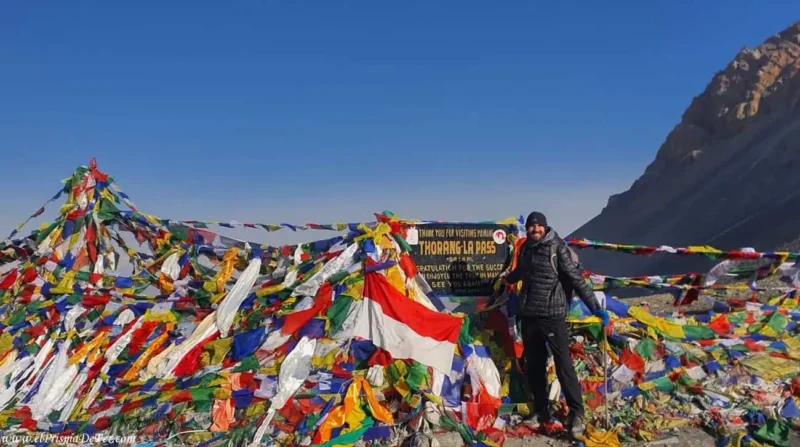
Day 8: Cross Thorong La Pass and descend to Muktinath (and Tatopani)
| Distance |
| 16 km |
| Estimated time |
| 6-9 hs |
| Elevation Profile |
| From 4540 mts – 5416mts – 3760 mts |
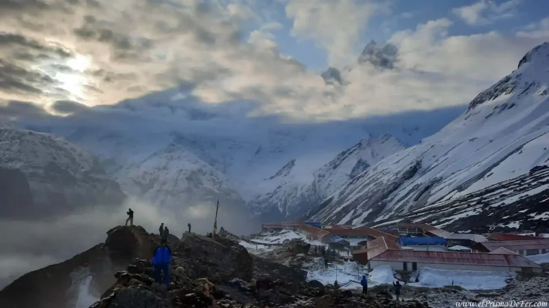
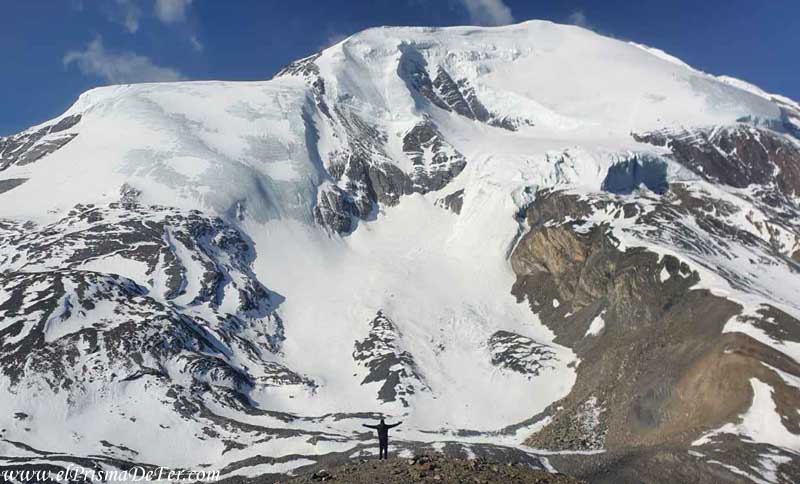
Finally, the day of the famous Thorong La Pass crossing arrived. I slept very badly, barely a wink of sleep because of the cold, even though I was fully dressed, in my sleeping bag and with the blankets they give you at the refuge.
The usual start time is around 4 a.m., because the climb is slow and demanding. It's almost 900 meters of elevation gain to reach 5,416 meters, and after midday the weather up there can worsen considerably, so they recommend arriving as early as possible.
The ascent is done at a very leisurely pace; at that altitude you quickly run out of breath and there's no other option but to accept your body's rhythm. Also, this section was the first time I had to walk on snow, a rather slippery stretch at times.
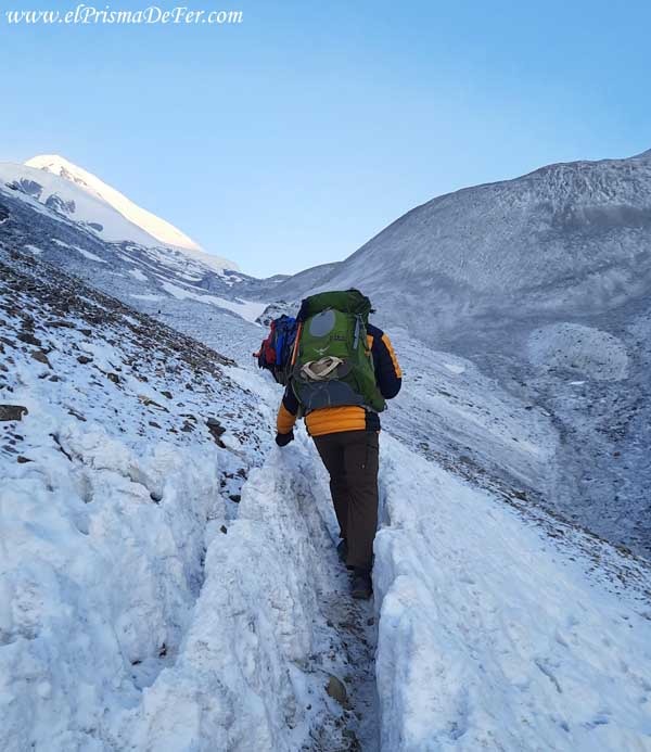
It took me an hour to get to High Camp and then another 2 hours to Thorong La, but the time is relative to each person's pace.
Thorong La
When I finally reached the pass, I felt a very strong mixture of relief, pride, and self-realization, as it was the highest point I had ever reached while walking.
I stood there for a few minutes, gazing at the landscape and trying to process that I had actually done it. After several days of nonstop walking (although the record is still held by the Camino de Santiago), cold, and altitude, crossing the Thorong La was a small personal feat, and I was overcome with immense happiness for having pushed my body and mind to that limit.
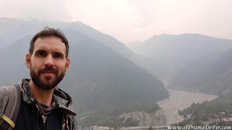
After a well-deserved rest, the long and steady descent began (approximately three hours). Although my knees were complaining, the positive aspect was that with every meter I descended, so did the cold and the altitude.
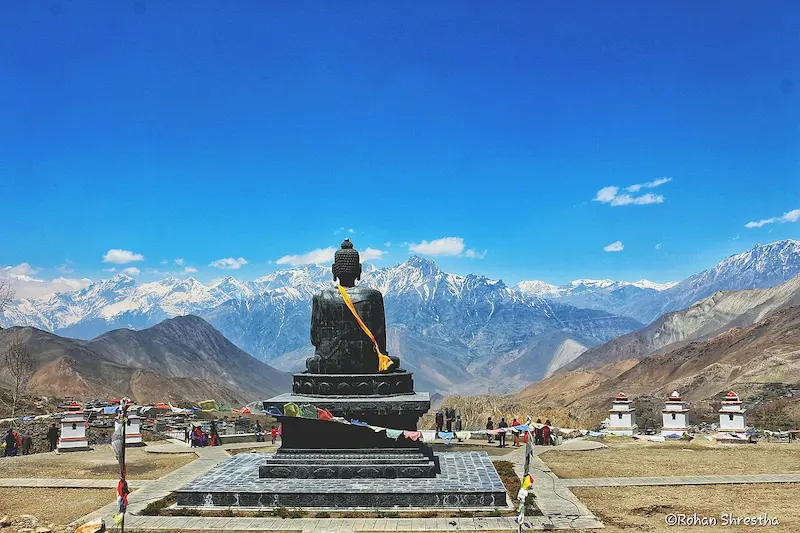
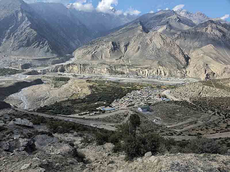
Muktinath
The usual plan is to end the day in Muktinath, a city I didn't like. I found it too crowded, dusty, and noisy. It's a sacred place for Hinduism, with a very important temple that attracts many pilgrims, but after the silence of the mountain, the contrast was quite jarring.
So much so, that I couldn't stand it for long and decided to take a bus to Tatopani, located about 4 hours from Muktinath, to rest. It's at a much lower altitude (1100 meters) and has the great added benefit of natural hot springs, which are perfect for recovering after the effort of the crossing.
It was a very long day, and logically, the best thing would have been to sleep in Muktinath. But between the cold and the stark contrast between the city and the silence of the mountains, the place didn't make me want to stay at all. So I decided to continue my journey.
I preferred to make an extra effort and rest in a more pleasant, quiet town with a much warmer climate.
Day 9: Rest in Tatopani
This day was completely relaxing in Tatopani. I didn't do much more than eat well and relax in the hot springs, which are the town's main attraction.
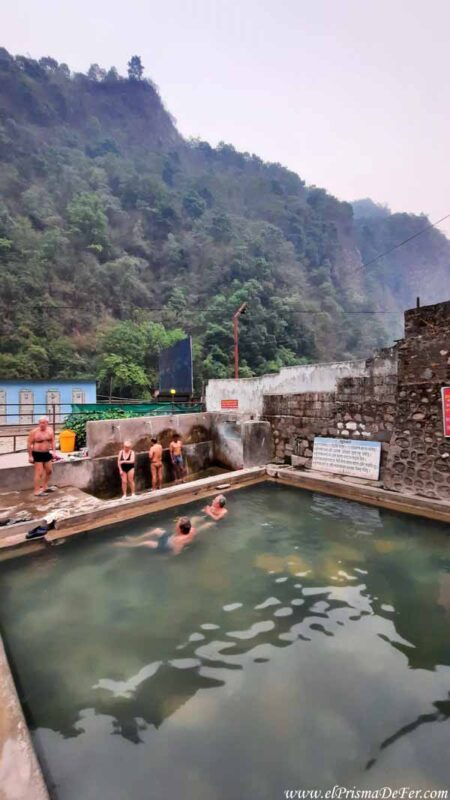
There are two: one near the teahouse area (see location) and another a little further away, across the river (see on map).
After crossing the Thorong La pass, getting into the hot water was almost therapeutic; I felt my body suddenly loosen up after several days of exertion.
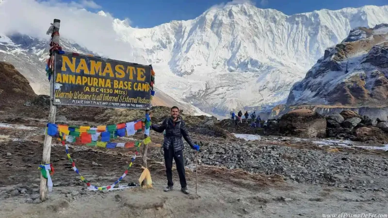
I decided to take it easy that day because the next day I was going to start the other challenge: the trek to Annapurna Base Camp. That part of the trip deserves its own story, so I'll tell it in another post.
Is it worth walking between Muktinath and Tatopani?
The stages between Muktinath and Tatopani are quite different from what I experienced before the pass. The landscape becomes drier, dustier, and more open, with an almost desert-like feel in some sections, and much of the route is shared with roads used by jeeps.
This significantly diminishes the sense of isolation and nature that characterizes the first half of the circuit. There are interesting canyons and villages that maintain a certain local identity, but it's no longer that quiet, high-mountain environment that accompanies you all the way to the Thorong La pass.
Is it worth doing on foot? It largely depends on your time and what you're looking for. If you want to complete the classic circuit on foot, it has its symbolic value. But if you're short on time or feel you've already experienced the most challenging part of the trek at the pass crossing, taking transport and moving faster, as I did, doesn't seem like a bad idea.
Personally, I didn't feel like I was missing out on the best part of the circuit, which for me is clearly on the north side and in the lead-up to Thorong La.
Final thoughts on the Annapurna Circuit
I thoroughly enjoyed the circuit, with the minor exception of the smoke that accompanied me for the first few days and slightly obscured some of the views.
I didn't find the trek particularly demanding physically, except for the altitude on the day we crossed the pass. The rest of the time I found it very walkable, and what I enjoyed most wasn't just the scenery, but also the mountain villages, with their blend of Tibetan culture, rural life, and hospitality that makes you want to linger longer at each stop.
I wished I could have added more days, especially to visit Tilicho Lake and perhaps hike the final stretch to Tatopani. But since my plan was to continue on to Annapurna Base Camp, I didn't have much time.
Even so, because of the variety of landscapes, the altitude, the culture and the feeling of a long journey, for me it remains one of the best treks in the world in terms of diversity.
Support The Prism of Fer!
Your support helps me continue creating free content on the blog. Thank you so much!